AUS 57 - Dampier Archipelago Nautical Chart
AUS 57 — Dampier Archipelago, WA Nautical Chart
For skippers, pilots, and coastal crews weaving the Pilbara’s island channels
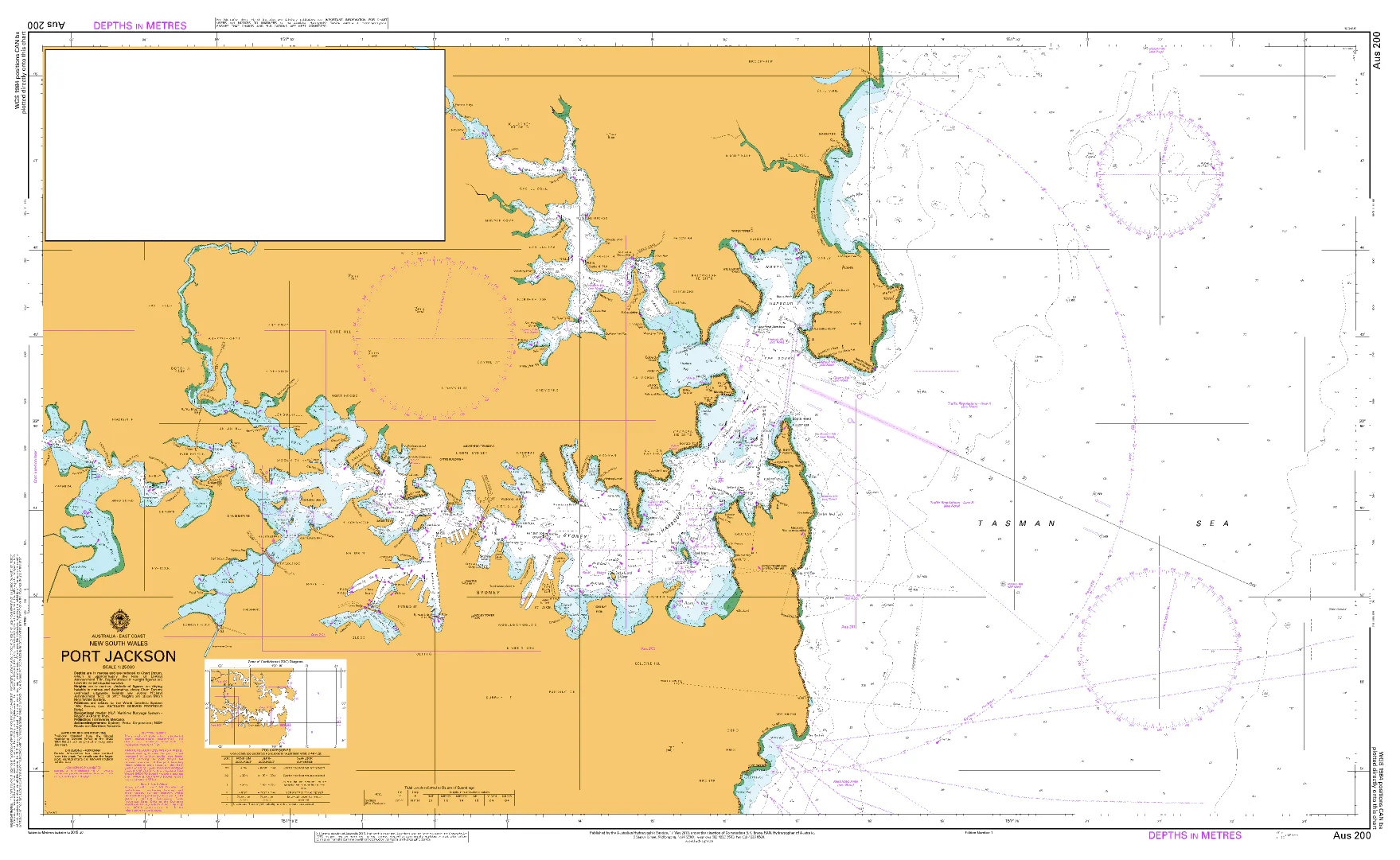
Plan safe passages through the island-studded waters off Karratha with AUS 57. Regional coverage at 1:75,000 on Mercator projection — ideal for shaping tracks, clearing bearings, and waypoint checks across the Dampier Archipelago.
Why skippers choose this chart
-
🧭 Archipelago overview — 1:75,000 brings balanced detail for reefs, channels, and anchorages.
-
🚢 Traffic & approach awareness — Useful for aligning routes around commercial fairways and loading areas.
-
🛰️ Mercator projection — Straight-line bearings and simple DR plotting across open reaches.
-
📍 Exact bounds — Quick position checks with listed N/S/E/W limits (see below).
-
🗺️ Deck-ready materials — 🗺️ Soft-matte writeable face accepts chart-correction/grease pencils.
-
🇦🇺 Printed in Australia — Colour-managed, hand-checked.
Coverage
-
Main Chart — AUS 57: Australia North West Coast · Western Australia · Dampier Archipelago
-
Scale: 1:75,000 · Projection: Mercator
-
Bounds: N 20°17.37′ S · S 20°43.92′ S · E 117°06.08′ E · W 116°21.50′ E
-
Publication: 22-Aug-1988 · Latest Edition: 21-Jun-2024
-
Premium materials & finishes
-
Paper (120 gsm matte) — Crisp, flexible, chart-table friendly; ideal under nav-station glass.
-
Laminated (soft-matte front / gloss back, edge-sealed) — Front is low-glare and writeable; gloss back adds rigidity. Wipes clean with a soft cloth.
Note: We use a soft-matte writeable face with a gloss reverse so you can annotate fixes, tides, and ETAs directly on the chart, then clean down between passages.
On-board & ashore use
-
🧭 Pilotage & route shaping — Plot channels, clearing bearings, and contingencies through the islands.
-
📒 Crew briefings — Clear layout for hazards, marks, and waypoint verification.
-
🛠️ Bridge/club display — Durable laminated option for training rooms and noticeboards.
-
🎁 Gift for skippers — A practical Pilbara sheet for WA crews.
Specifications
| Field | Detail |
|---|---|
| Chart Number | AUS 57 |
| Title | Australia North West Coast — Western Australia — Dampier Archipelago |
| Geographic Location | Australia |
| Scale (main) | 1:75,000 |
| Projection | Mercator |
| North / South Limits | 20°17.37′ S / 20°43.92′ S |
| East / West Limits | 117°06.08′ E / 116°21.50′ E |
| Publication Date | 22-Aug-1988 |
| Latest Edition | 21-Jun-2024 |
| Sheet Size | 1100 mm (W) × 770 mm (H) |
| Available Finishes | Paper (120 gsm matte); Laminated (soft-matte writeable front, gloss back, edge-sealed) |
| Inks | Pigment-based, fade-resistant |
| Origin | Printed in Australia |
Important note (mariner’s guidance)
This product is ideal for planning, briefing, education, and display. For underway navigation, always carry and consult the latest official hydrographic chart or approved ECDIS and current Notices to Mariners. Local conditions and aids may change.
Ready to work the Dampier Archipelago?
Select your finish above and add to cart. We’ll print locally, hand-check, and ship with care.
Original: $49.95
-70%$49.95
$14.98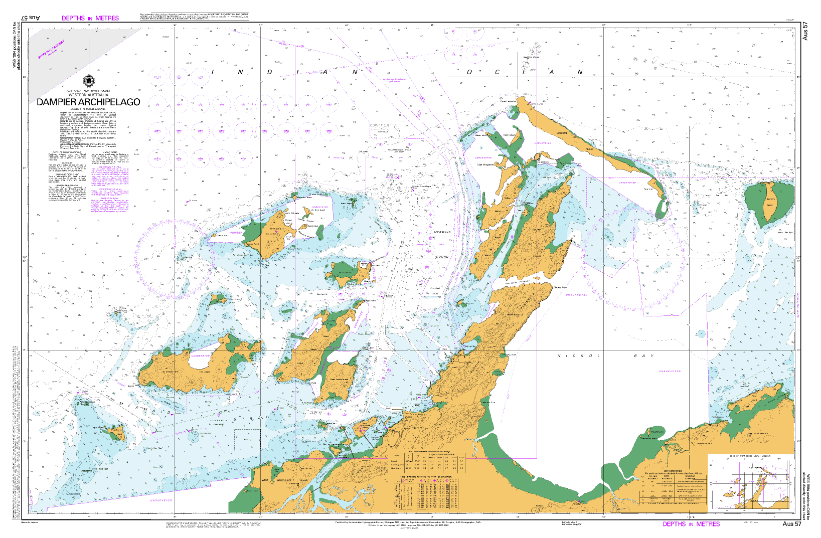
Description
AUS 57 — Dampier Archipelago, WA Nautical Chart
For skippers, pilots, and coastal crews weaving the Pilbara’s island channels
Plan safe passages through the island-studded waters off Karratha with AUS 57. Regional coverage at 1:75,000 on Mercator projection — ideal for shaping tracks, clearing bearings, and waypoint checks across the Dampier Archipelago.
Why skippers choose this chart
-
🧭 Archipelago overview — 1:75,000 brings balanced detail for reefs, channels, and anchorages.
-
🚢 Traffic & approach awareness — Useful for aligning routes around commercial fairways and loading areas.
-
🛰️ Mercator projection — Straight-line bearings and simple DR plotting across open reaches.
-
📍 Exact bounds — Quick position checks with listed N/S/E/W limits (see below).
-
🗺️ Deck-ready materials — 🗺️ Soft-matte writeable face accepts chart-correction/grease pencils.
-
🇦🇺 Printed in Australia — Colour-managed, hand-checked.
Coverage
-
Main Chart — AUS 57: Australia North West Coast · Western Australia · Dampier Archipelago
-
Scale: 1:75,000 · Projection: Mercator
-
Bounds: N 20°17.37′ S · S 20°43.92′ S · E 117°06.08′ E · W 116°21.50′ E
-
Publication: 22-Aug-1988 · Latest Edition: 21-Jun-2024
-
Premium materials & finishes
-
Paper (120 gsm matte) — Crisp, flexible, chart-table friendly; ideal under nav-station glass.
-
Laminated (soft-matte front / gloss back, edge-sealed) — Front is low-glare and writeable; gloss back adds rigidity. Wipes clean with a soft cloth.
Note: We use a soft-matte writeable face with a gloss reverse so you can annotate fixes, tides, and ETAs directly on the chart, then clean down between passages.
On-board & ashore use
-
🧭 Pilotage & route shaping — Plot channels, clearing bearings, and contingencies through the islands.
-
📒 Crew briefings — Clear layout for hazards, marks, and waypoint verification.
-
🛠️ Bridge/club display — Durable laminated option for training rooms and noticeboards.
-
🎁 Gift for skippers — A practical Pilbara sheet for WA crews.
Specifications
| Field | Detail |
|---|---|
| Chart Number | AUS 57 |
| Title | Australia North West Coast — Western Australia — Dampier Archipelago |
| Geographic Location | Australia |
| Scale (main) | 1:75,000 |
| Projection | Mercator |
| North / South Limits | 20°17.37′ S / 20°43.92′ S |
| East / West Limits | 117°06.08′ E / 116°21.50′ E |
| Publication Date | 22-Aug-1988 |
| Latest Edition | 21-Jun-2024 |
| Sheet Size | 1100 mm (W) × 770 mm (H) |
| Available Finishes | Paper (120 gsm matte); Laminated (soft-matte writeable front, gloss back, edge-sealed) |
| Inks | Pigment-based, fade-resistant |
| Origin | Printed in Australia |
Important note (mariner’s guidance)
This product is ideal for planning, briefing, education, and display. For underway navigation, always carry and consult the latest official hydrographic chart or approved ECDIS and current Notices to Mariners. Local conditions and aids may change.
Ready to work the Dampier Archipelago?
Select your finish above and add to cart. We’ll print locally, hand-check, and ship with care.