Australasia Political Maps International 1200 x 1000mm Wall Map
Australia • New Zealand • Indonesia • Papua New Guinea — on one definitive sheet
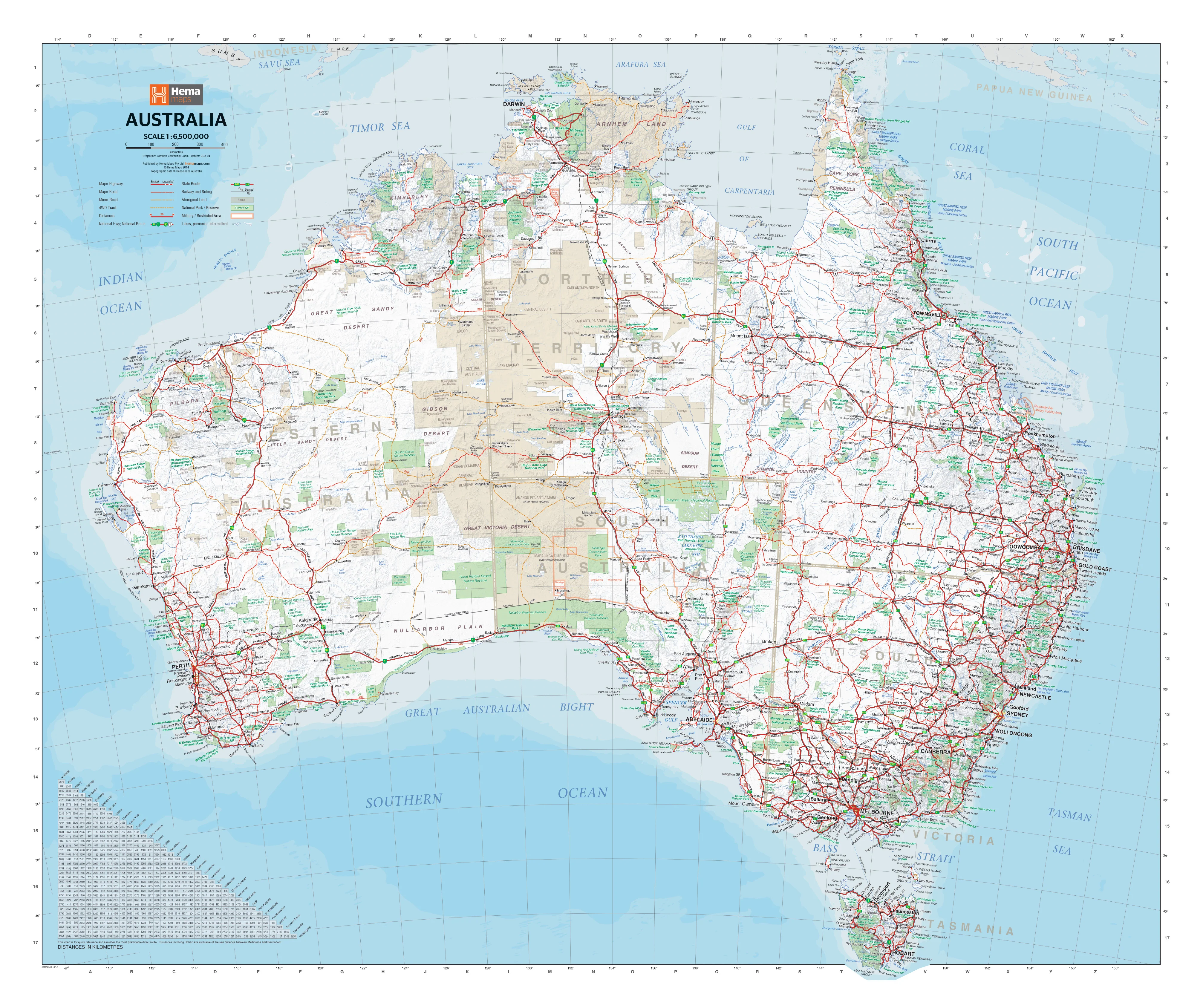
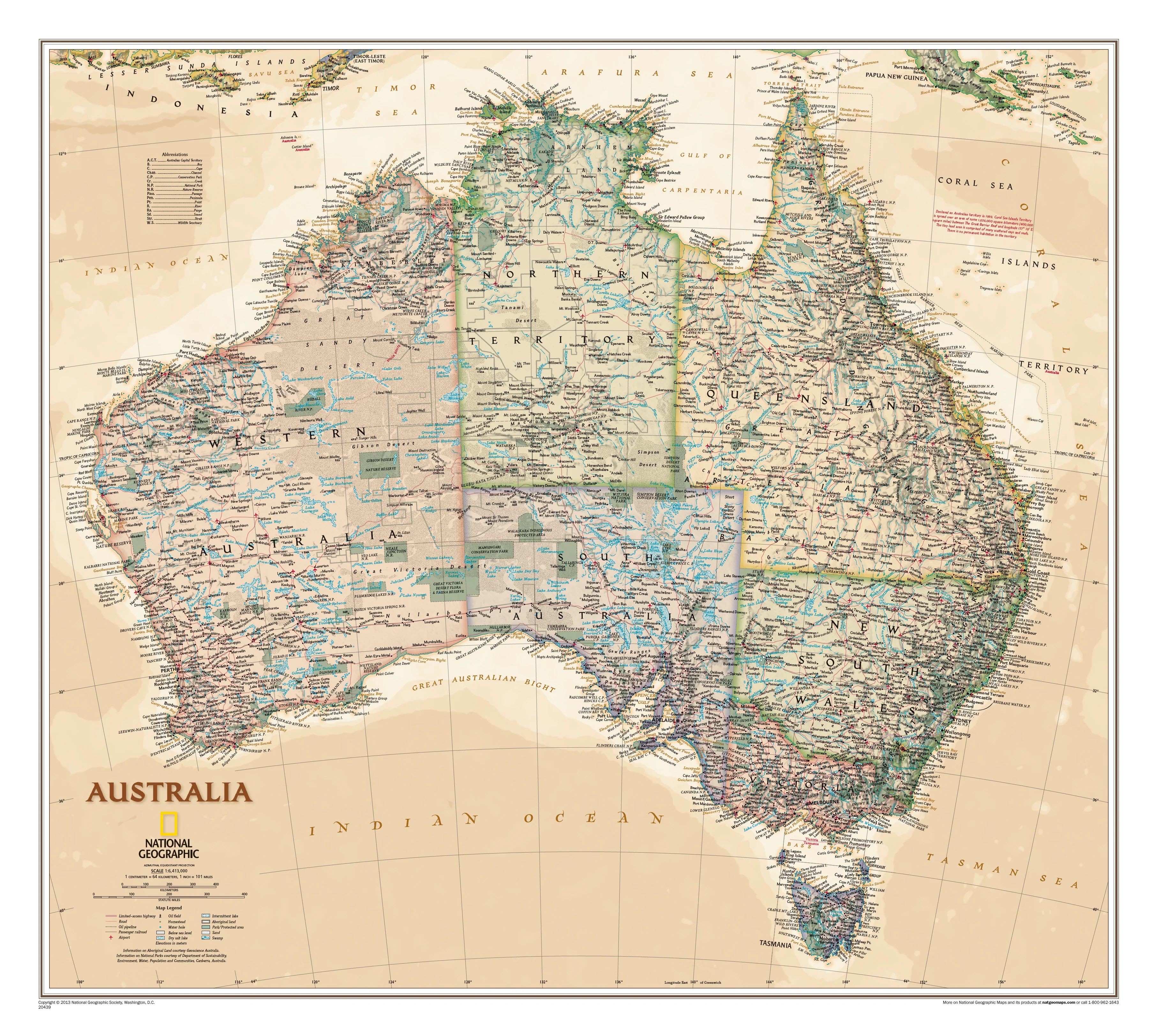
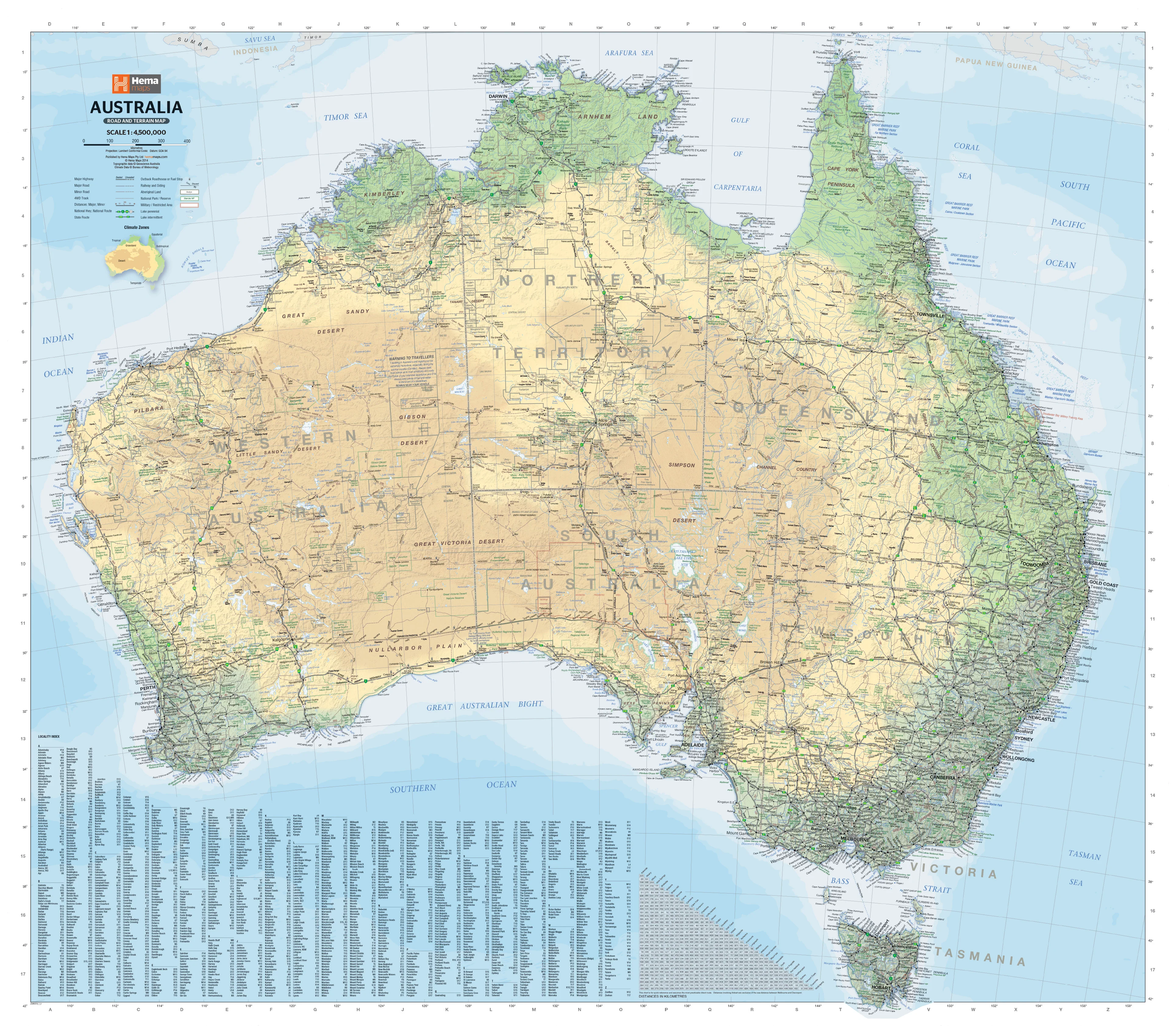
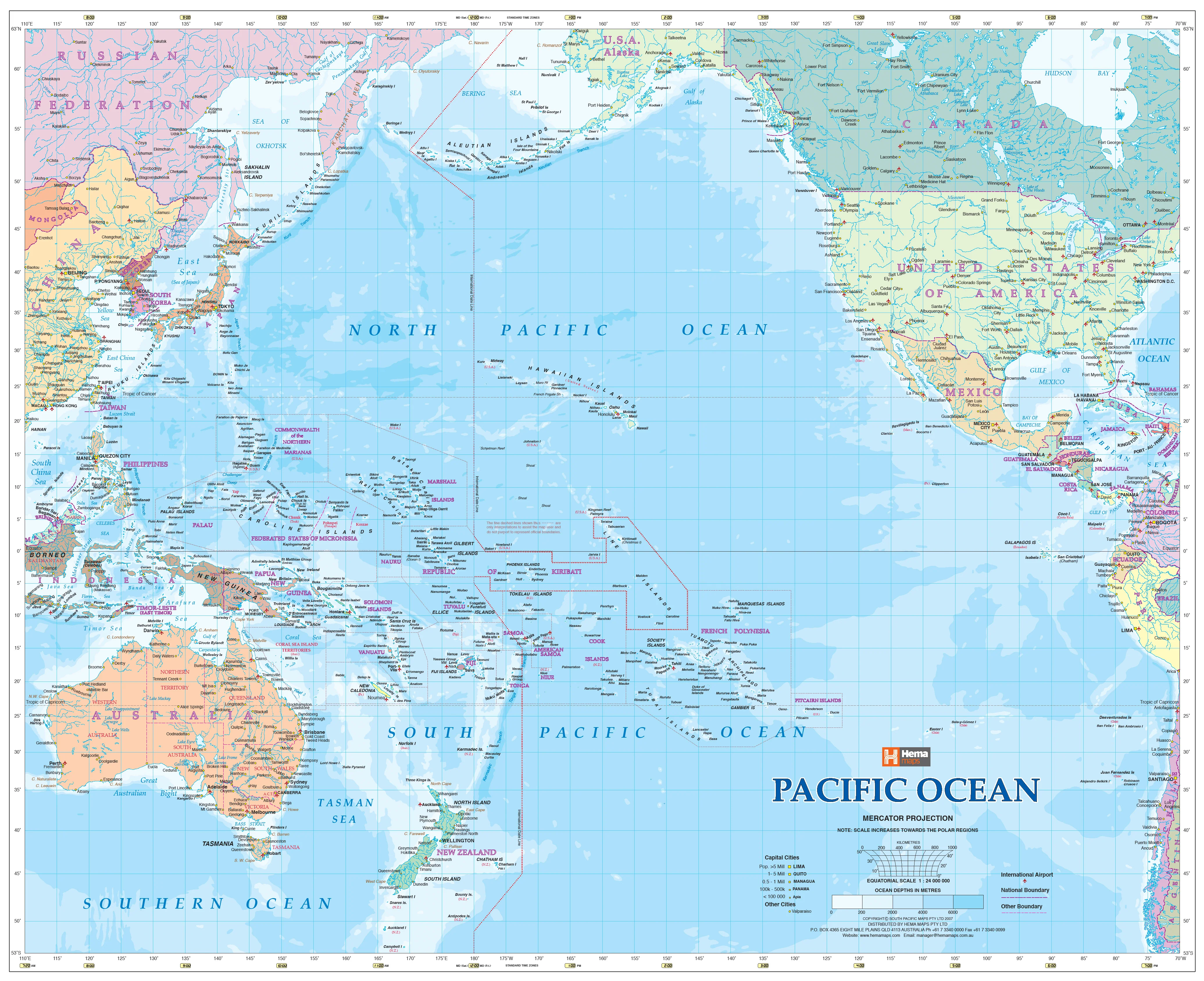
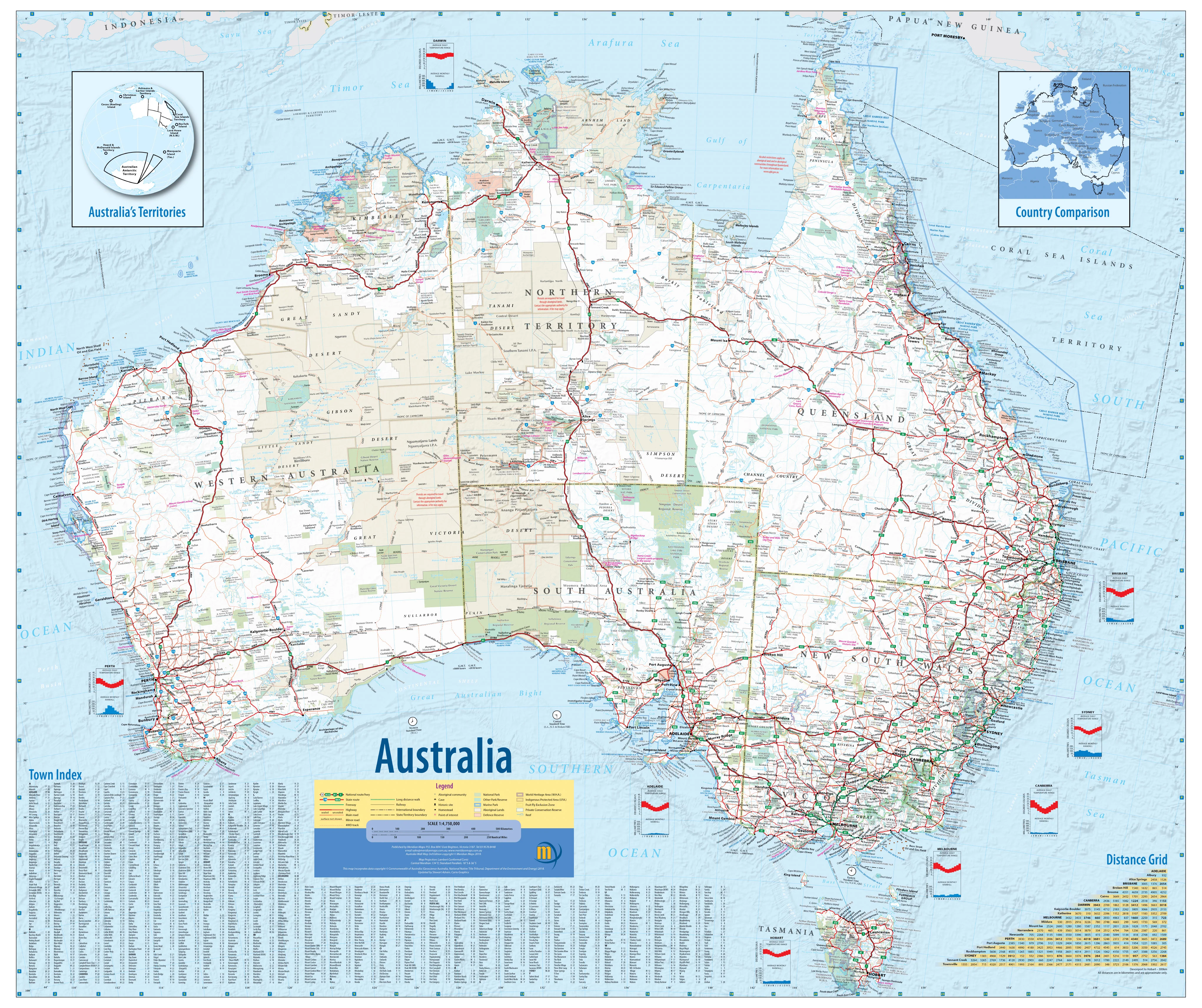
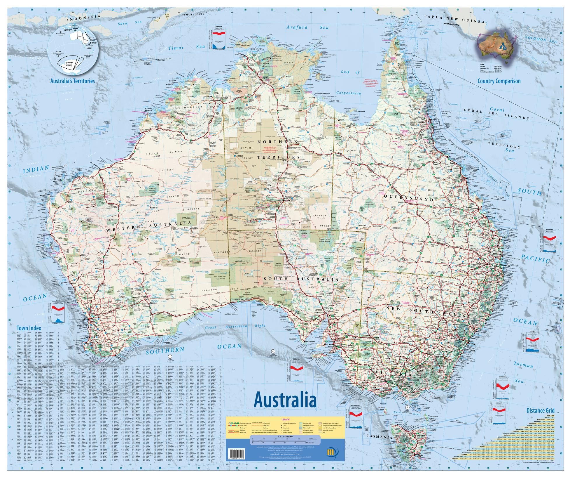
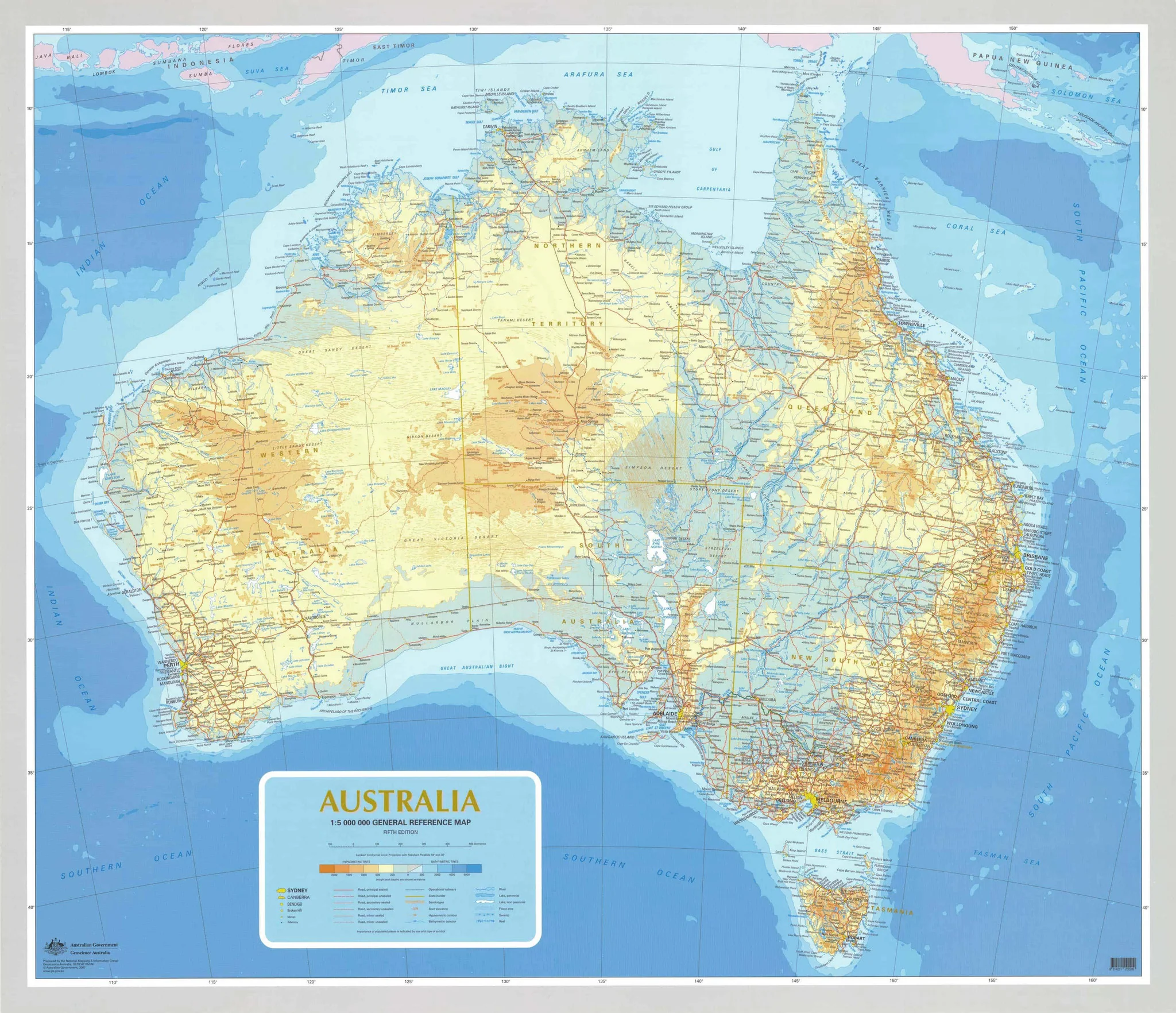
Bring the wider Asia–Pacific into sharp focus with this beautifully presented Australasia Political Wall Map by Maps International—one of the few maps that dedicates a single, large-format canvas to Australia, New Zealand, Indonesia, Papua New Guinea, Timor-Leste and neighbouring Pacific islands. A vibrant political palette is paired with subtle relief shading for an engaging view that’s equal parts educational and display-worthy.
🗺️ Why this map stands out
-
Unique regional coverage — The full sweep of Australasia on one sheet, including offshore archipelagos and key island groups for true context.
-
Political clarity + terrain context — Bold country and state boundaries supported by relief shading to reveal mountain systems, plateaus and coastal shelves.
-
Wall-readable cartography — Clean hierarchy, crisp labelling, and carefully balanced colour make it easy to read from a distance.
-
Multi-purpose design — Ideal for teaching, logistics & export planning, travel inspiration, boardrooms and modern interiors.
-
Context beyond borders — Major seas, straits and ocean basins labelled for a fuller grasp of regional trade, climate and migration routes.
🌏 Coverage at a glance
-
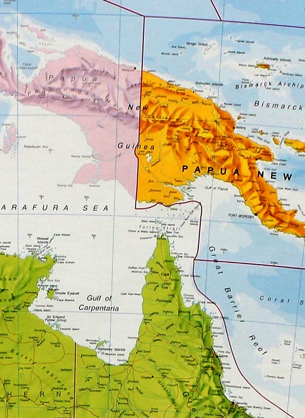
Core nations: Australia (states & territories), New Zealand (North & South Islands), Indonesia (with principal provinces), Papua New Guinea, Timor-Leste.
-
Neighbouring islands: Pacific island groups and key external territories shown in situ for accurate regional orientation.
-
Key features: Capitals and major cities, principal transport corridors, selected ports and airports, major rivers and highland ranges.
🔎 Cartographic details you’ll appreciate
-
Relief shading to express topography without overpowering political information.
-
Ocean & coastal labelling (seas, straits, gulfs) for navigation and trade context.
-
Clear symbol set for settlements and features; intuitive legend for quick reference.
-
Latitude/longitude grid and scale bar for lesson planning, estimating distances and coordinates.
-
Colour-managed print for consistent appearance under classroom and office lighting.
🧭 Ideal for
-
Educators & geography teachers building lessons on regional politics, landforms and climate.
-
Businesses & logistics teams mapping supply chains, corridors and market footprints across APAC.
-
Travel planners & tourism operators visualising routes, hubs and seasonal patterns.
-
Home offices & study nooks seeking a smart, global focal point that sparks conversation.
-
Gifts for students, globetrotters and Australasia enthusiasts.
✨ Available finishes
| Format | Description |
|---|---|
| 📜 Paper (160 gsm matte) | Archival, matte-coated paper — perfect for framing under glass. |
| 🧼 Laminated (Encapsulated) | Fully sealed in 2 × 80-micron gloss laminate — durable, waterproof, write-on/wipe-off. |
| 🖼️ Canvas (395 gsm HP Professional Matte) | Gallery-quality texture with pigment-based, fade-resistant inks — premium, long-life display. |
| 🪵 Laminated + Timber Hang Rails | Natural timber rails (top & bottom) with hanging cord — ready to hang. Allow up to 10 working days. |
| 🪵 Canvas + Timber Hang Rails | Canvas mounted in natural timber rails — frameless, refined. Allow up to 10 working days. |
📐 Specifications
| Feature | Details |
|---|---|
| Title | Australasia Political Wall Map |
| Publisher | Maps International |
| Coverage | Australia, New Zealand, Indonesia, Papua New Guinea, Timor-Leste & neighbouring islands |
| Style | Political with shaded relief |
| Size (unframed) | 1200 mm (W) × 1000 mm (H) |
| Pigment-based inks on 160 gsm matte (other finishes available) | |
| Finish Options | Paper • Laminated (encapsulated) • Canvas • Hang-railed (laminated/canvas) |
| Origin | Made in Australia |
🧪 Classroom & workspace use ideas
-
Comparative studies: Population, languages, climates and biomes across Australasia.
-
Trade & logistics: Trace export routes, ports, air hubs and regional time zones.
-
Field skills: Teach bearings, scale and distance estimation with the grid and scale bar.
-
Assessment displays: Pin notes, routes and case studies on laminated/canvas versions.
🛠️ Mounting & care tips
-
Framing: Paper prints suit standard poster frames or custom frames with UV-protective glazing.
-
Write-on use: Laminated versions accept whiteboard markers; wipe clean with a soft cloth.
-
Hang rails: A minimalist, frameless display for studios, classrooms and flexible spaces.
-
Canvas care: Dust lightly with a dry microfiber cloth; avoid prolonged direct sunlight.
🤝 Our Commitment
-
Local craftsmanship: Designed, printed and finished in Australia.
-
Premium materials: Archival HP pigment inks, professional laminates, natural timber rails.
-
Colour-managed clarity: Wall-readable labelling and consistent cartography at large format.
-
Built to last: Durable finishes to extend service life and reduce waste.
-
Packed with care: Every map is hand-checked and shipped to arrive clean and display-ready.
🚚 Delivery & lead times
-
Paper, laminated, canvas (rolled): typically dispatch within 1–2 business days.
-
Hang-railed options: made to order — please allow up to 10 working days for professional mounting.
-
Shipped rolled in sturdy tubes for transit protection.
Highlight the dynamic geography of Australasia with a map that informs, inspires and endures.
Add to cart and see the whole region — clearly, beautifully — in one place.
Original: $129.95
-70%$129.95
$38.98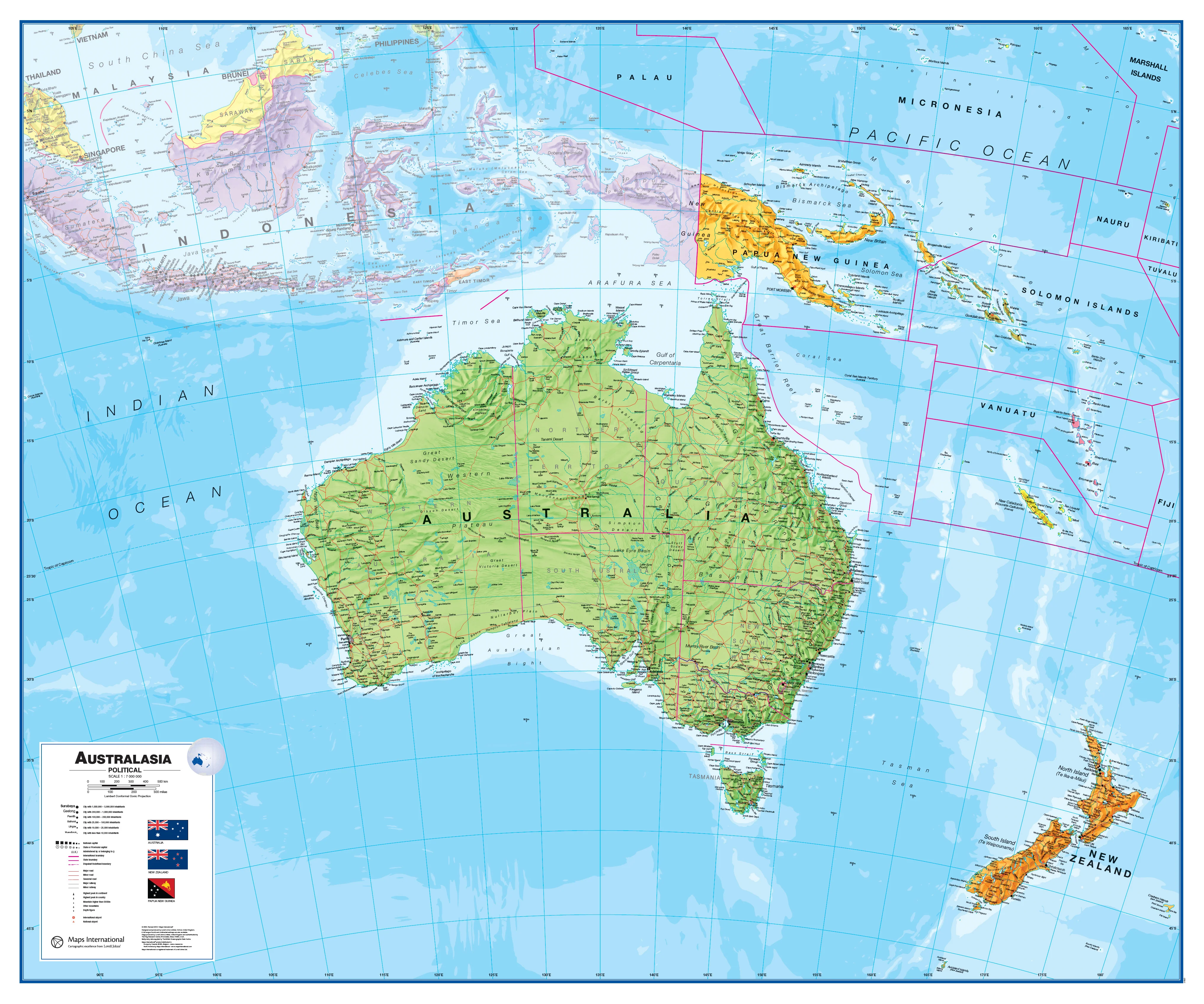
Description
Australia • New Zealand • Indonesia • Papua New Guinea — on one definitive sheet
Bring the wider Asia–Pacific into sharp focus with this beautifully presented Australasia Political Wall Map by Maps International—one of the few maps that dedicates a single, large-format canvas to Australia, New Zealand, Indonesia, Papua New Guinea, Timor-Leste and neighbouring Pacific islands. A vibrant political palette is paired with subtle relief shading for an engaging view that’s equal parts educational and display-worthy.
🗺️ Why this map stands out
-
Unique regional coverage — The full sweep of Australasia on one sheet, including offshore archipelagos and key island groups for true context.
-
Political clarity + terrain context — Bold country and state boundaries supported by relief shading to reveal mountain systems, plateaus and coastal shelves.
-
Wall-readable cartography — Clean hierarchy, crisp labelling, and carefully balanced colour make it easy to read from a distance.
-
Multi-purpose design — Ideal for teaching, logistics & export planning, travel inspiration, boardrooms and modern interiors.
-
Context beyond borders — Major seas, straits and ocean basins labelled for a fuller grasp of regional trade, climate and migration routes.
🌏 Coverage at a glance
-
Core nations: Australia (states & territories), New Zealand (North & South Islands), Indonesia (with principal provinces), Papua New Guinea, Timor-Leste.
-
Neighbouring islands: Pacific island groups and key external territories shown in situ for accurate regional orientation.
-
Key features: Capitals and major cities, principal transport corridors, selected ports and airports, major rivers and highland ranges.
🔎 Cartographic details you’ll appreciate
-
Relief shading to express topography without overpowering political information.
-
Ocean & coastal labelling (seas, straits, gulfs) for navigation and trade context.
-
Clear symbol set for settlements and features; intuitive legend for quick reference.
-
Latitude/longitude grid and scale bar for lesson planning, estimating distances and coordinates.
-
Colour-managed print for consistent appearance under classroom and office lighting.
🧭 Ideal for
-
Educators & geography teachers building lessons on regional politics, landforms and climate.
-
Businesses & logistics teams mapping supply chains, corridors and market footprints across APAC.
-
Travel planners & tourism operators visualising routes, hubs and seasonal patterns.
-
Home offices & study nooks seeking a smart, global focal point that sparks conversation.
-
Gifts for students, globetrotters and Australasia enthusiasts.
✨ Available finishes
| Format | Description |
|---|---|
| 📜 Paper (160 gsm matte) | Archival, matte-coated paper — perfect for framing under glass. |
| 🧼 Laminated (Encapsulated) | Fully sealed in 2 × 80-micron gloss laminate — durable, waterproof, write-on/wipe-off. |
| 🖼️ Canvas (395 gsm HP Professional Matte) | Gallery-quality texture with pigment-based, fade-resistant inks — premium, long-life display. |
| 🪵 Laminated + Timber Hang Rails | Natural timber rails (top & bottom) with hanging cord — ready to hang. Allow up to 10 working days. |
| 🪵 Canvas + Timber Hang Rails | Canvas mounted in natural timber rails — frameless, refined. Allow up to 10 working days. |
📐 Specifications
| Feature | Details |
|---|---|
| Title | Australasia Political Wall Map |
| Publisher | Maps International |
| Coverage | Australia, New Zealand, Indonesia, Papua New Guinea, Timor-Leste & neighbouring islands |
| Style | Political with shaded relief |
| Size (unframed) | 1200 mm (W) × 1000 mm (H) |
| Pigment-based inks on 160 gsm matte (other finishes available) | |
| Finish Options | Paper • Laminated (encapsulated) • Canvas • Hang-railed (laminated/canvas) |
| Origin | Made in Australia |
🧪 Classroom & workspace use ideas
-
Comparative studies: Population, languages, climates and biomes across Australasia.
-
Trade & logistics: Trace export routes, ports, air hubs and regional time zones.
-
Field skills: Teach bearings, scale and distance estimation with the grid and scale bar.
-
Assessment displays: Pin notes, routes and case studies on laminated/canvas versions.
🛠️ Mounting & care tips
-
Framing: Paper prints suit standard poster frames or custom frames with UV-protective glazing.
-
Write-on use: Laminated versions accept whiteboard markers; wipe clean with a soft cloth.
-
Hang rails: A minimalist, frameless display for studios, classrooms and flexible spaces.
-
Canvas care: Dust lightly with a dry microfiber cloth; avoid prolonged direct sunlight.
🤝 Our Commitment
-
Local craftsmanship: Designed, printed and finished in Australia.
-
Premium materials: Archival HP pigment inks, professional laminates, natural timber rails.
-
Colour-managed clarity: Wall-readable labelling and consistent cartography at large format.
-
Built to last: Durable finishes to extend service life and reduce waste.
-
Packed with care: Every map is hand-checked and shipped to arrive clean and display-ready.
🚚 Delivery & lead times
-
Paper, laminated, canvas (rolled): typically dispatch within 1–2 business days.
-
Hang-railed options: made to order — please allow up to 10 working days for professional mounting.
-
Shipped rolled in sturdy tubes for transit protection.
Highlight the dynamic geography of Australasia with a map that informs, inspires and endures.
Add to cart and see the whole region — clearly, beautifully — in one place.