Australia Hema Handy Map 12th Edition
🦘 Your Compact, All-Australia Travel Companion
🗺️ Fully Updated National Map with City Insets | 📏 Foldable, Lightweight & Durable | 🚙 Ideal for Road Trips, Planning & Quick Reference
🧭 Explore Australia with Confidence
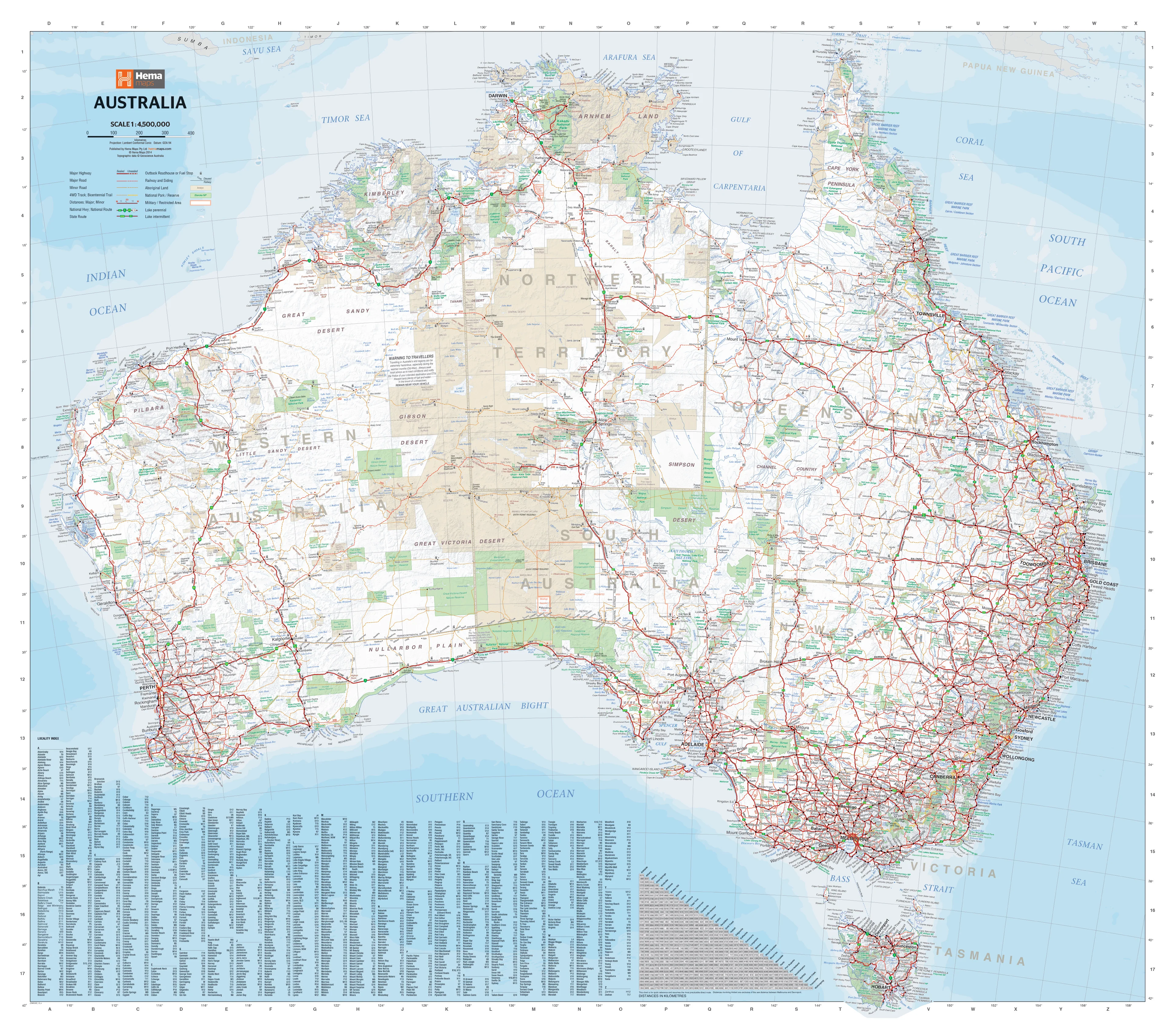
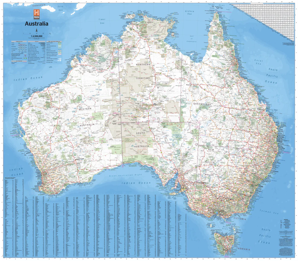
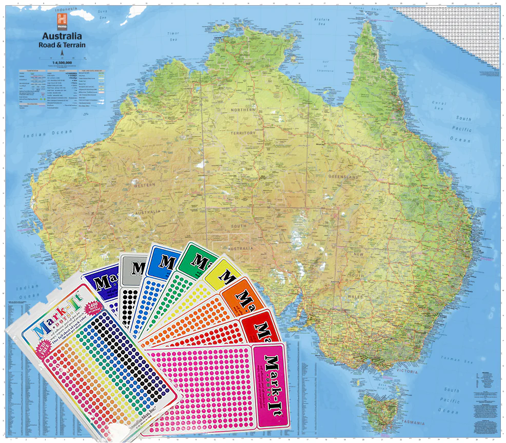
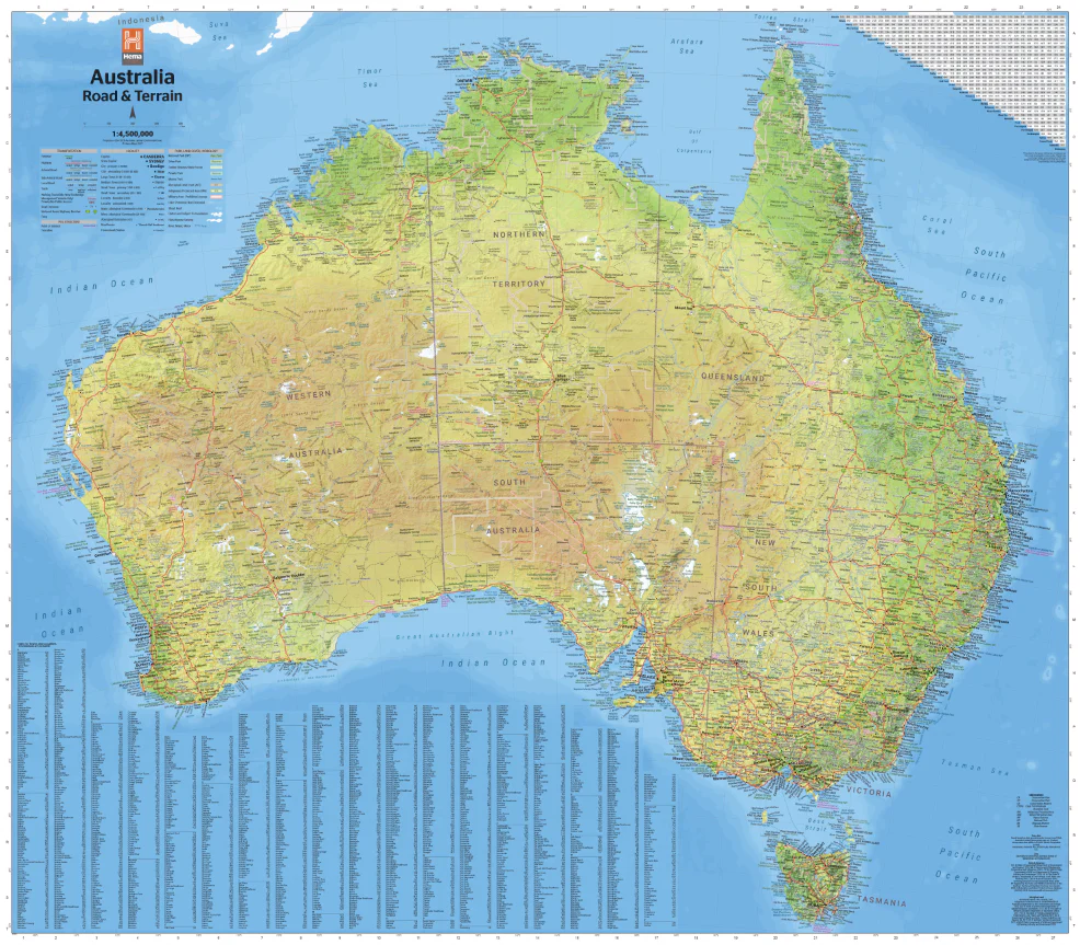
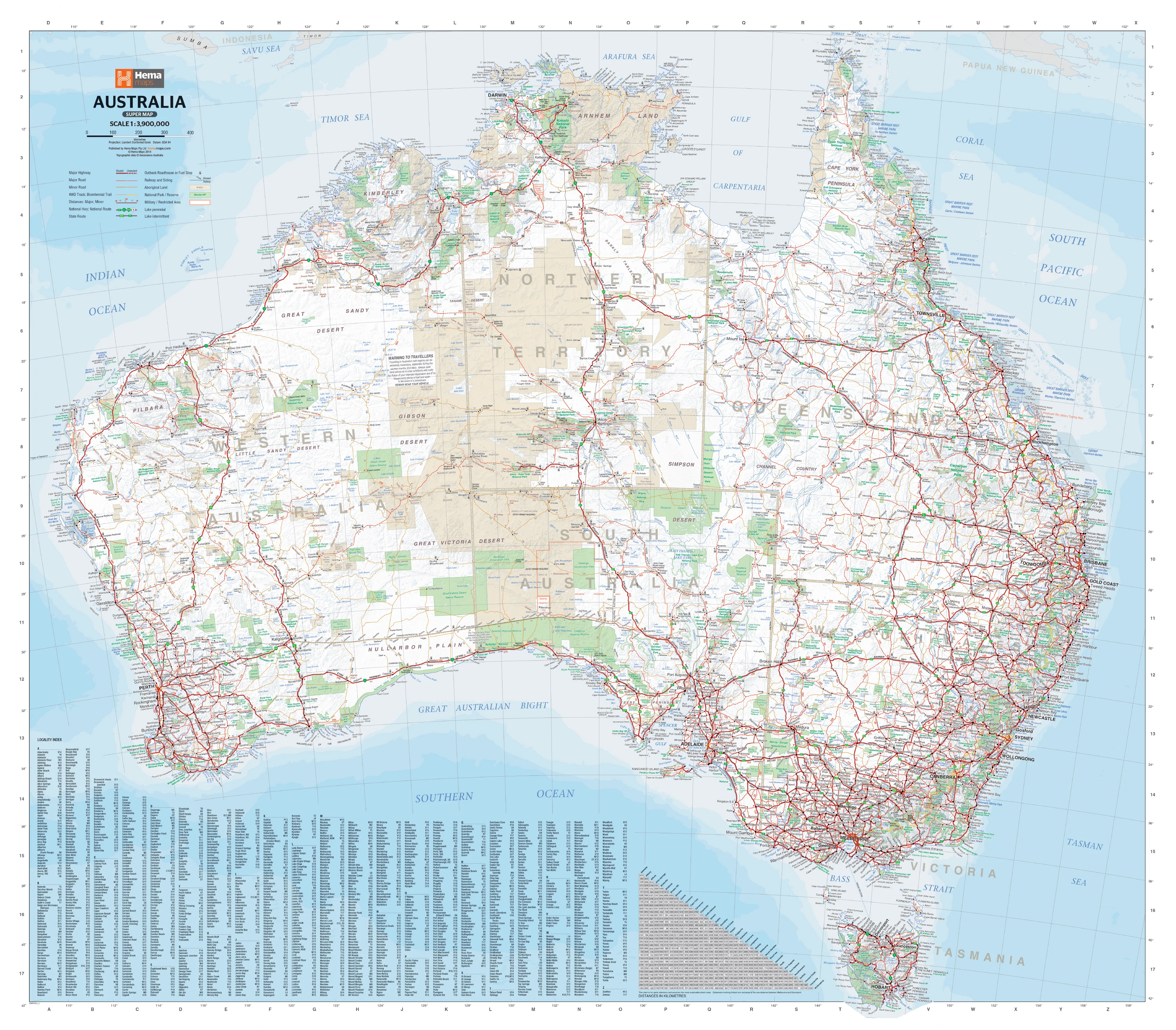
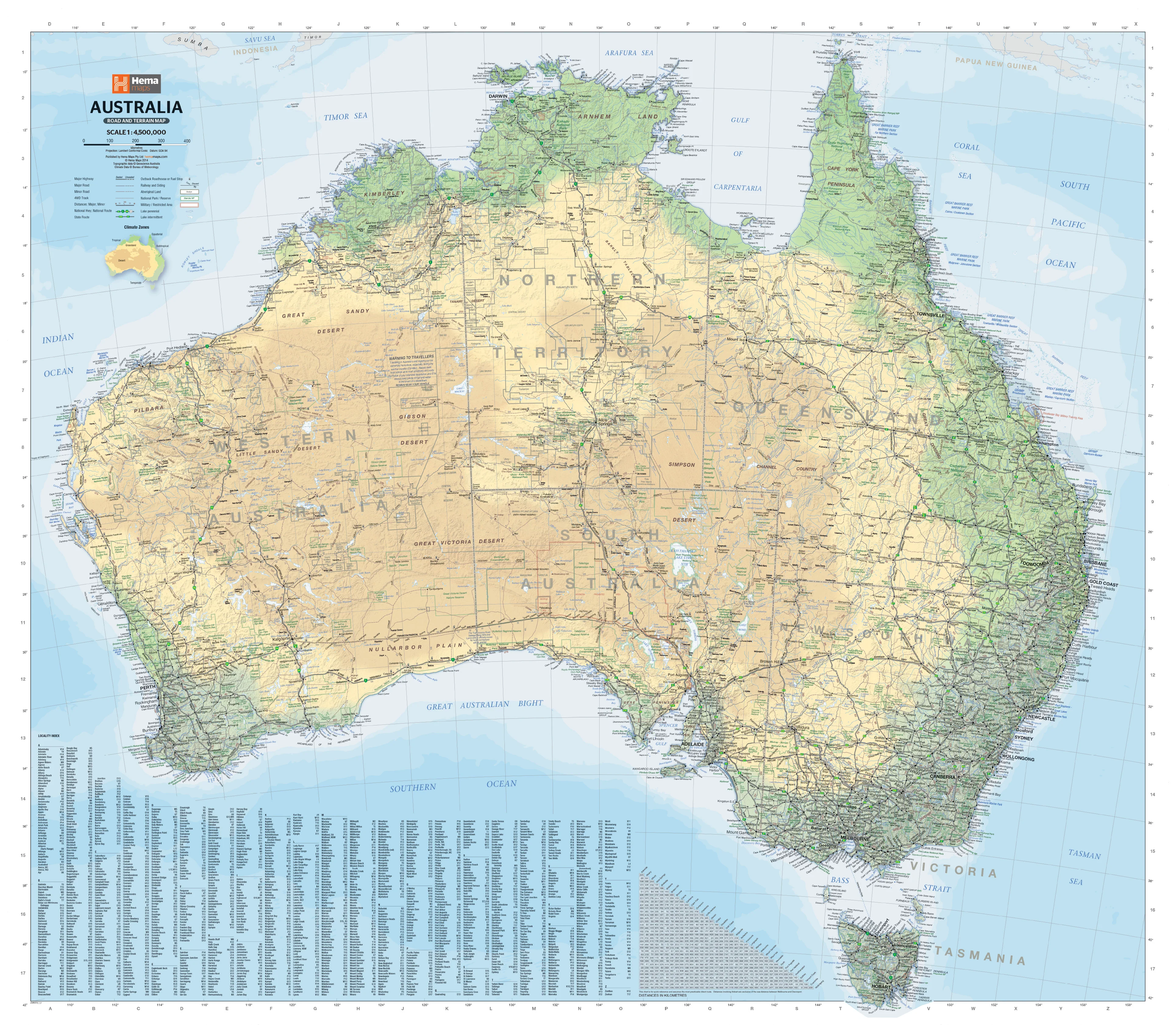
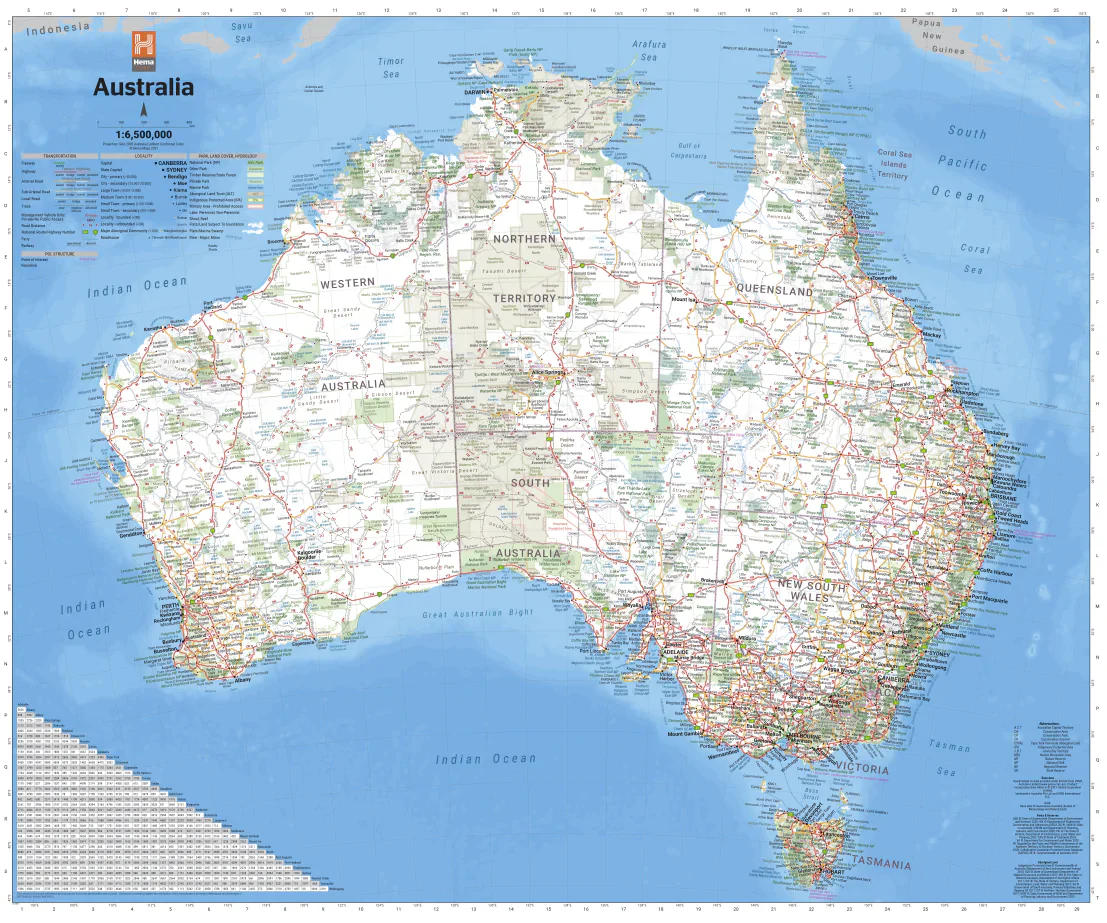
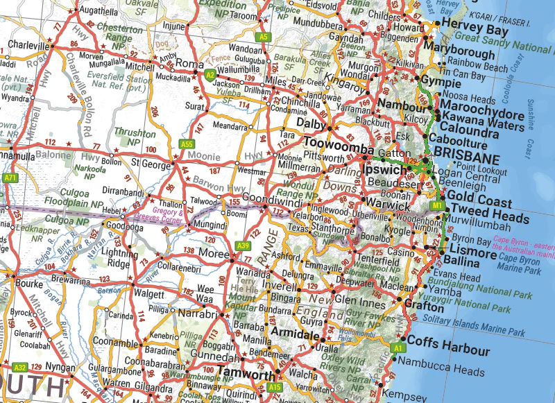
Whether you're travelling across the Nullarbor, venturing into the Outback, or city-hopping from Sydney to Perth, the Hema Handy Map of Australia – 12th Edition is the perfect travel essential. Designed for ease of use on the road, this foldable map is compact enough to fit in your glovebox, day pack, or caravan drawer, yet detailed enough to give a clear overview of the entire country.
Printed by Australia’s most trusted mapmaker, Hema Maps, this handy-sized map includes a national overview with major and secondary road networks, state borders, and highlighted national parks—plus inset city maps on the reverse for key metropolitan areas.
🌟 Key Features & Benefits
✅ National Coverage at Convenient Scale
-
Covers all of Australia with clear topographic and political boundaries
-
Easy-to-read scale of 1:6,500,000 – perfect for long-range planning
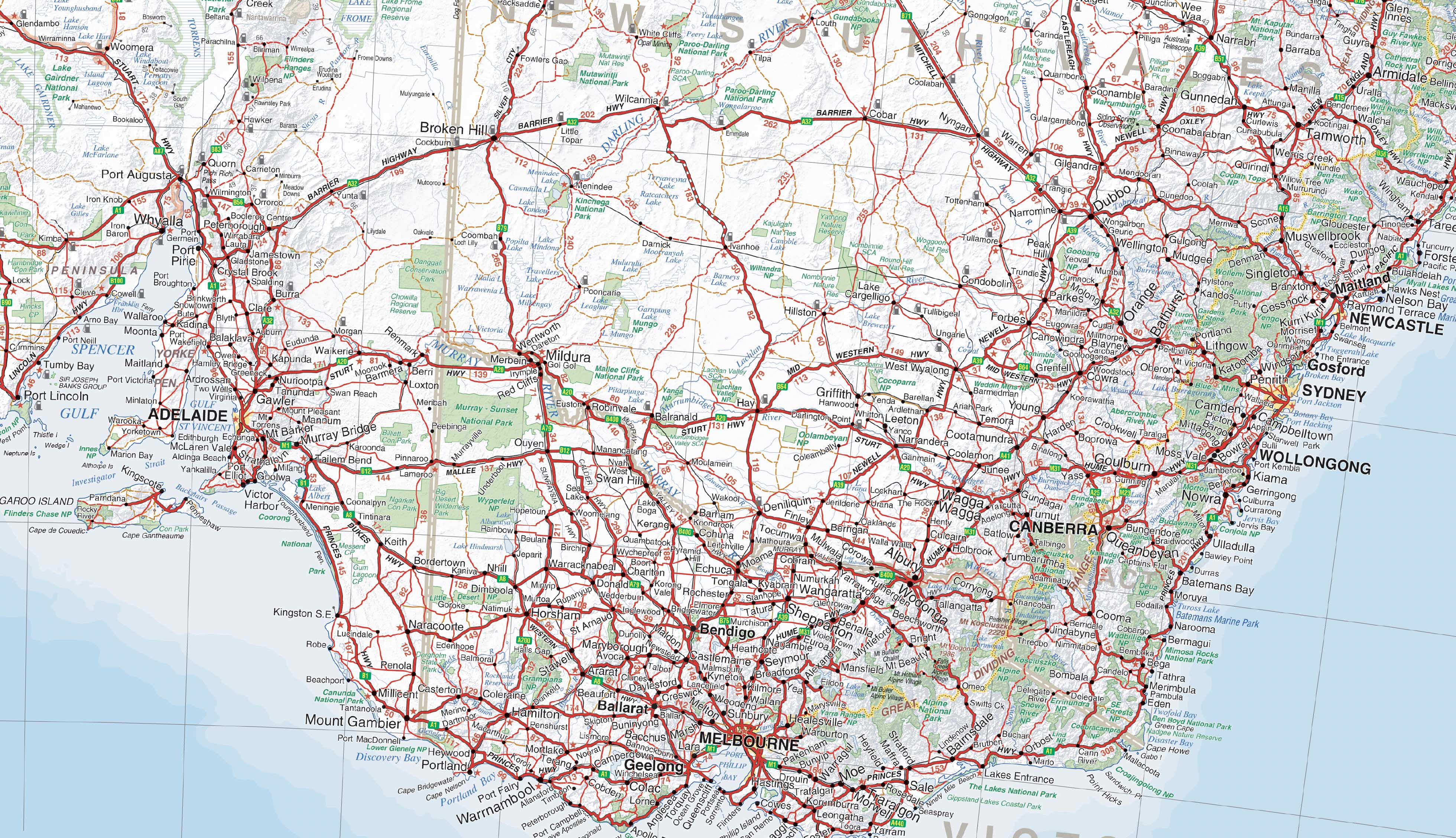
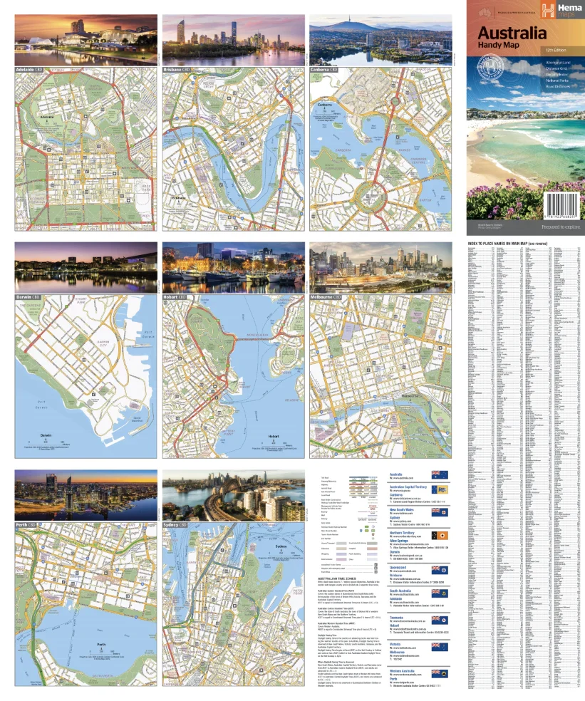
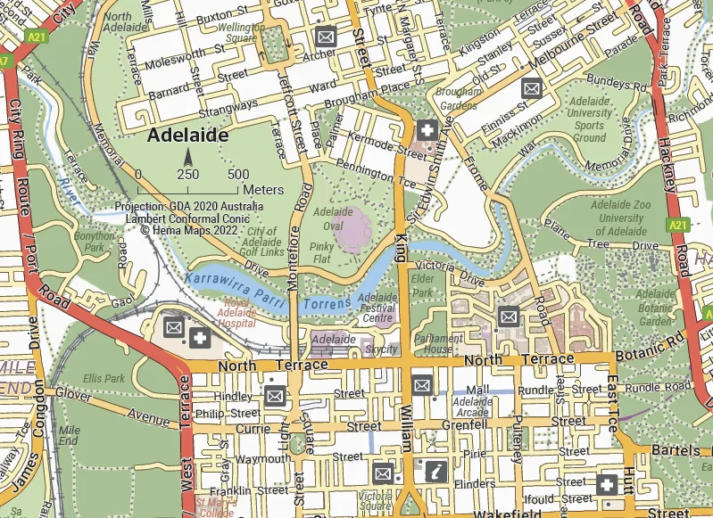
✅ City Maps on Reverse Side
-
Includes detailed inset maps of major cities for quick urban navigation
-
Helpful for locating landmarks, major roads, and city bypasses
✅ Distance Grid & Road Distances
-
Plan your stops and fuel breaks with precision
-
Ideal for estimating travel times between key destinations
✅ National Parks & Points of Interest
-
Major national parks and protected areas clearly marked
-
Useful for nature lovers, 4WD explorers, and outdoor adventurers
✅ Compact & Foldable Design
-
Folds down small for easy storage
-
Lightweight and durable – a reliable map for any backpack or glovebox
📐 Product Specifications
| Specification | Detail |
|---|---|
| Edition | 12th Edition |
| Scale | 1:6,500,000 |
| Unfolded Size | 750 mm (W) x 625 mm (H) |
| Format | Folded paper map |
| Publisher | Hema Maps |
| National Parks Shown | Yes |
| City Insets | Yes – major cities included |
| Road Distances/Grid | Yes |
| Weight | Lightweight and travel-friendly |
🧳 Who’s It For?
-
🚐 Caravaners & Grey Nomads exploring the Australian highways
-
🏕️ Campers and nature enthusiasts looking for park access and scenic routes
-
📚 Teachers and students needing a classroom reference
-
🚙 Urban travellers seeking easy-to-read city maps
-
🧭 Backup navigators who value having a physical map on hand
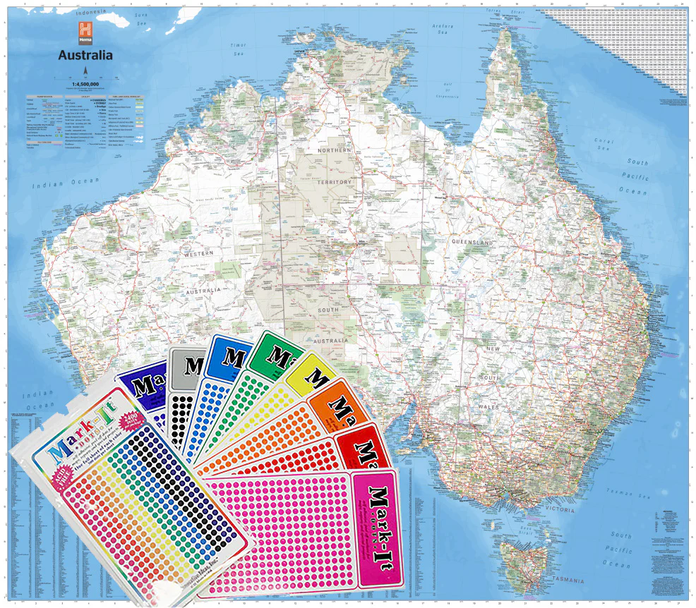
🛠️ Optional Add-Ons
-
Lamination available upon request – for added durability and use with whiteboard markers
-
Bundle with other Hema titles such as state maps or atlases for a complete travel set
From coastlines to red deserts, this compact map covers it all.
Plan, navigate, and explore Australia with confidence — the Hema Handy Map makes it easy.
Original: $11.95
-70%$11.95
$3.58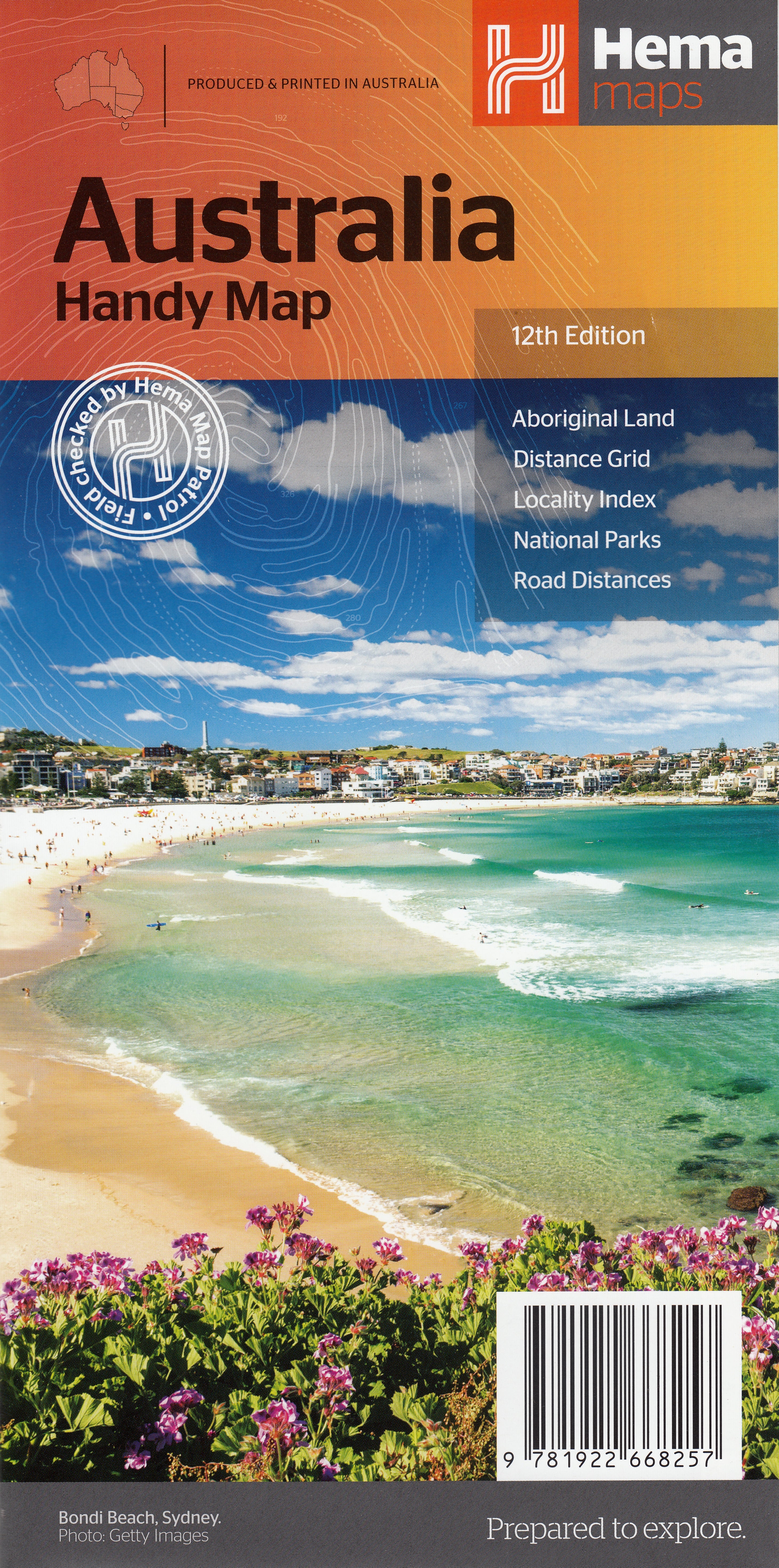
Description
🦘 Your Compact, All-Australia Travel Companion
🗺️ Fully Updated National Map with City Insets | 📏 Foldable, Lightweight & Durable | 🚙 Ideal for Road Trips, Planning & Quick Reference
🧭 Explore Australia with Confidence
Whether you're travelling across the Nullarbor, venturing into the Outback, or city-hopping from Sydney to Perth, the Hema Handy Map of Australia – 12th Edition is the perfect travel essential. Designed for ease of use on the road, this foldable map is compact enough to fit in your glovebox, day pack, or caravan drawer, yet detailed enough to give a clear overview of the entire country.
Printed by Australia’s most trusted mapmaker, Hema Maps, this handy-sized map includes a national overview with major and secondary road networks, state borders, and highlighted national parks—plus inset city maps on the reverse for key metropolitan areas.
🌟 Key Features & Benefits
✅ National Coverage at Convenient Scale
-
Covers all of Australia with clear topographic and political boundaries
-
Easy-to-read scale of 1:6,500,000 – perfect for long-range planning
✅ City Maps on Reverse Side
-
Includes detailed inset maps of major cities for quick urban navigation
-
Helpful for locating landmarks, major roads, and city bypasses
✅ Distance Grid & Road Distances
-
Plan your stops and fuel breaks with precision
-
Ideal for estimating travel times between key destinations
✅ National Parks & Points of Interest
-
Major national parks and protected areas clearly marked
-
Useful for nature lovers, 4WD explorers, and outdoor adventurers
✅ Compact & Foldable Design
-
Folds down small for easy storage
-
Lightweight and durable – a reliable map for any backpack or glovebox
📐 Product Specifications
| Specification | Detail |
|---|---|
| Edition | 12th Edition |
| Scale | 1:6,500,000 |
| Unfolded Size | 750 mm (W) x 625 mm (H) |
| Format | Folded paper map |
| Publisher | Hema Maps |
| National Parks Shown | Yes |
| City Insets | Yes – major cities included |
| Road Distances/Grid | Yes |
| Weight | Lightweight and travel-friendly |
🧳 Who’s It For?
-
🚐 Caravaners & Grey Nomads exploring the Australian highways
-
🏕️ Campers and nature enthusiasts looking for park access and scenic routes
-
📚 Teachers and students needing a classroom reference
-
🚙 Urban travellers seeking easy-to-read city maps
-
🧭 Backup navigators who value having a physical map on hand
🛠️ Optional Add-Ons
-
Lamination available upon request – for added durability and use with whiteboard markers
-
Bundle with other Hema titles such as state maps or atlases for a complete travel set
From coastlines to red deserts, this compact map covers it all.
Plan, navigate, and explore Australia with confidence — the Hema Handy Map makes it easy.