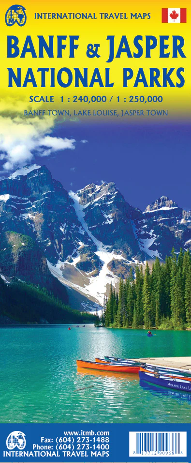
Jasper National Park & Northern Alberta ITMB Map
🏔️ Jasper National Park & Northern Alberta Map – ITMB
Double-Sided Travel Map | Scale 1:250,000 / 1:1,000,000 | Size: 690 x 1000 mm | Optional Lamination Available
Discover one of Canada’s most dramatic contrasts in geography and climate with this two-in-one map from ITMB. On one side, explore the rugged alpine beauty of Jasper National Park in the Canadian Rockies. On the reverse, navigate the vast boreal expanse of Northern Alberta—a region of energy riches, extreme weather, and untamed wilderness.
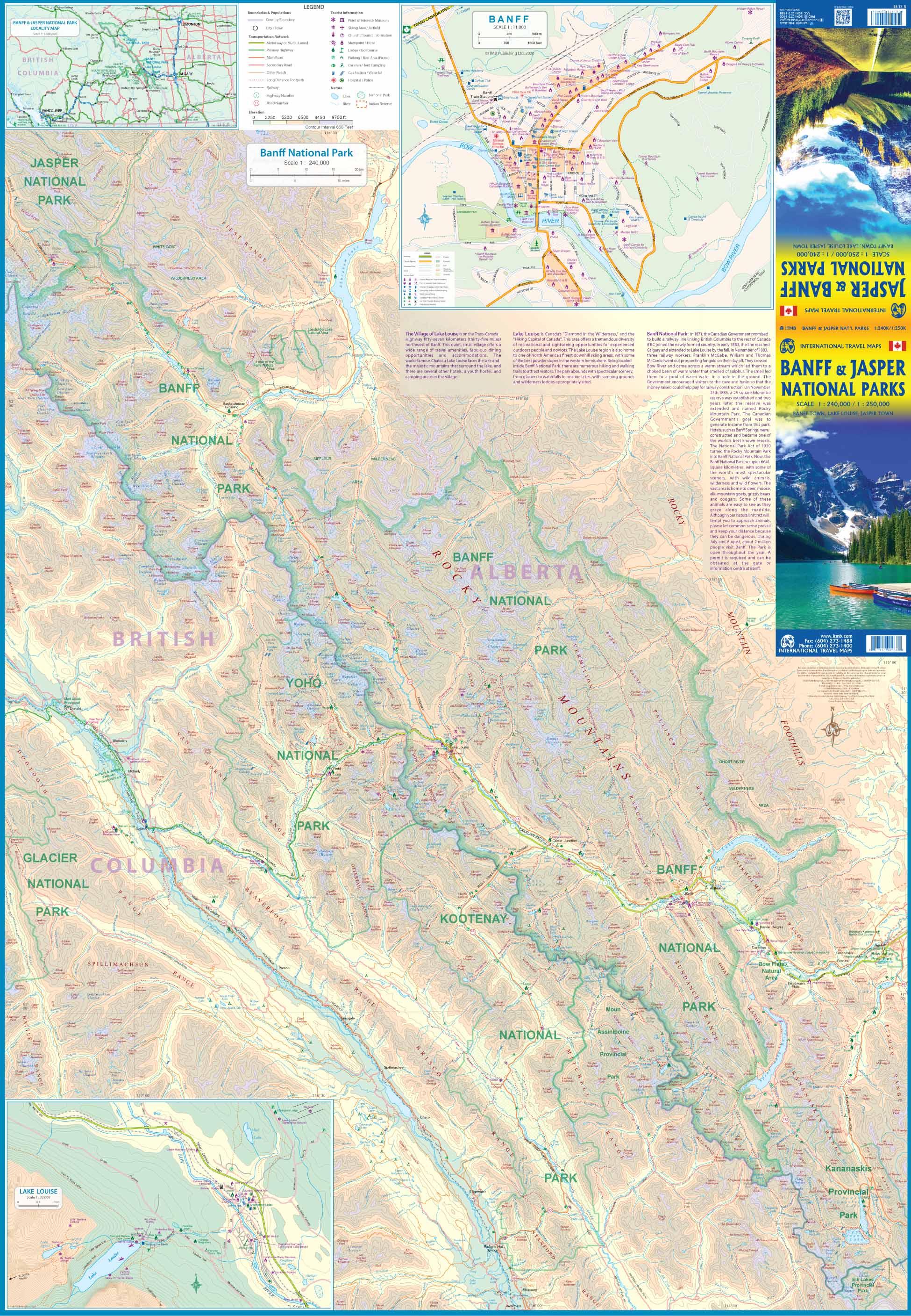
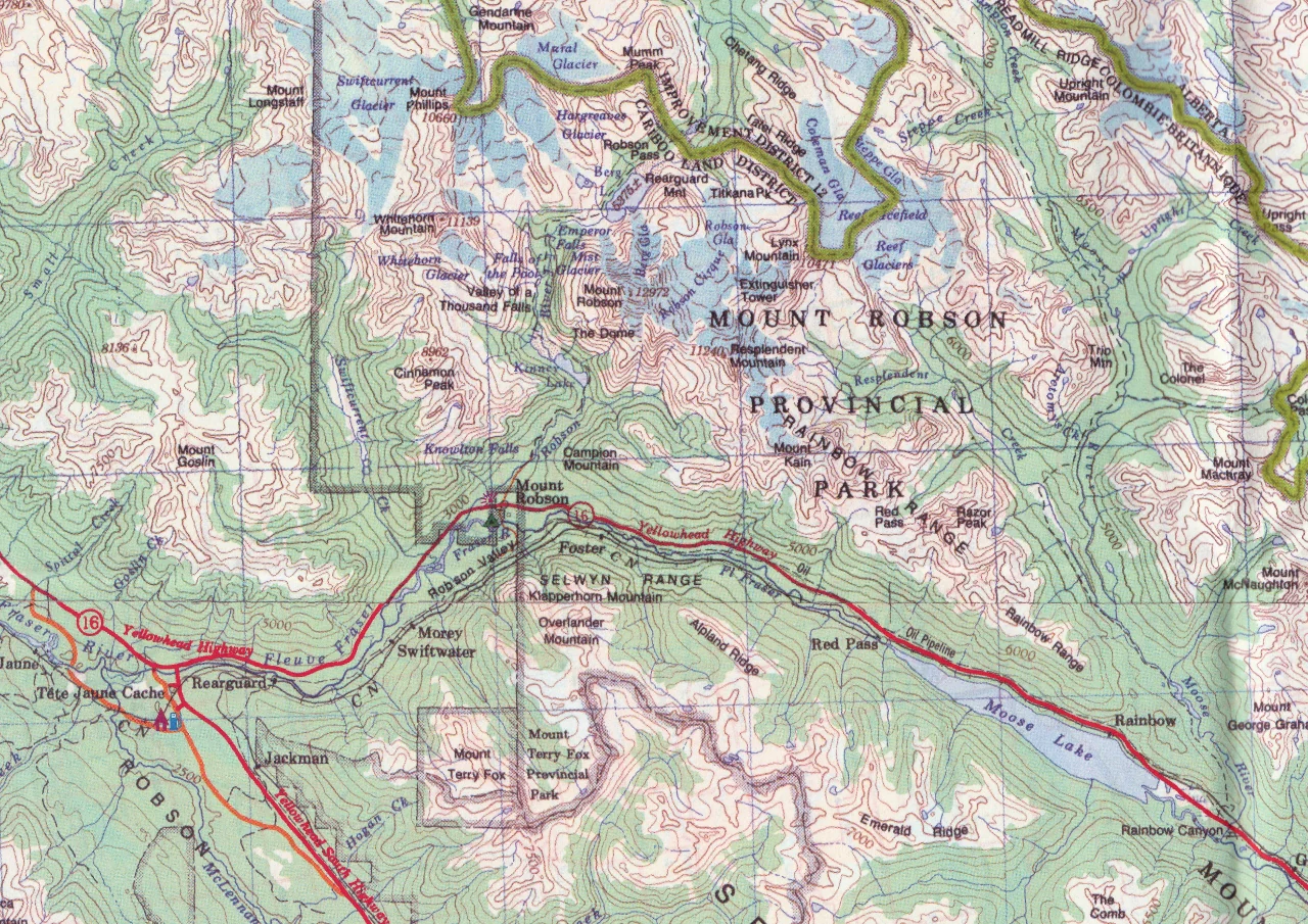
🏞️ Side 1: Jasper National Park (Scale 1:250,000)
Nestled in the heart of the Alberta Rockies, Jasper National Park is the largest national park in the Canadian Rockies and a UNESCO World Heritage Site. This detailed map captures the park’s wild alpine terrain and includes:
-
🏔️ Major peaks, glaciers, and ridgelines
-
🛣️ The Icefields Parkway and Trans-Canada Highway
-
🥾 Hiking trails and campgrounds
-
🦌 Wildlife viewing zones and scenic viewpoints
-
🗺️ Detailed insets of Jasper townsite and surrounding access points
Whether you're planning a road trip, a multi-day hike, or wildlife photography expedition, this map is your gateway to one of Canada’s most awe-inspiring national parks.
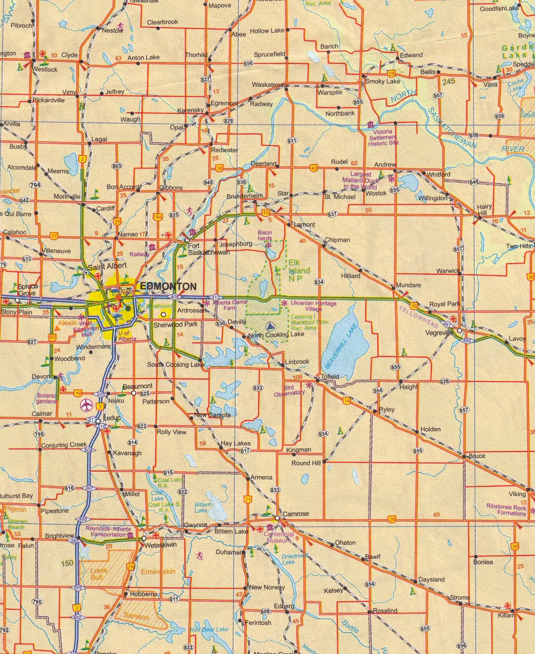
🌲 Side 2: Northern Alberta (Scale 1:1,000,000)
This expansive map reveals the vast and remote wilderness of Northern Alberta, stretching from the central boreal forest to the borders of the Northwest Territories. Key features include:
-
🛣️ Full regional road network and secondary highways
-
🏙️ Key towns and cities such as Fort McMurray, Edmonton, and Grande Prairie
-
🌐 Energy resource areas including oil sands zones
-
🌳 Provincial parks, lakes, rivers, and recreation areas
-
🧭 Insets of Edmonton and Fort McMurray for urban orientation
This side of the map is ideal for industrial, environmental, and recreational use, and is perfect for travellers heading to Wood Buffalo National Park, oil sands routes, or exploring backcountry Alberta.
📌 Map Features
| Feature | Details |
|---|---|
| Format | Folded, double-sided map |
| Scales | 1:250,000 (Jasper) / 1:1,000,000 (Northern Alberta) |
| Size | 690 mm x 1000 mm |
| Insets | Jasper townsite & Edmonton city |
| Points of Interest | Parks, trails, roads, rivers, lakes, and energy zones |
| Road Detail | Highways, scenic routes, secondary roads, access tracks |
| Topography | Relief shading, forest cover, rivers and lakes |
💧 Optional Lamination
Upgrade your map with durable lamination:
-
✅ Write on it with whiteboard markers
-
✅ Apply removable map dots for planning
-
✅ Water-resistant, tear-resistant, easy to clean
Note: Laminated versions are created by flattening and encapsulating the folded map in 80-micron gloss laminate. Slight fold lines will still be visible beneath the laminate.
🎯 Perfect For:
-
🚙 Driving the Icefields Parkway or Highway 63 to Fort McMurray
-
🥾 Hikers, climbers, and wildlife lovers visiting Jasper
-
🛢️ Resource sector professionals needing a practical map of Northern Alberta
-
🎒 Adventure travellers seeking untamed Canadian landscapes
Whether you're tracking moose through the alpine meadows of Jasper or navigating northern oilfield routes, this ITMB double-sided map is the ideal companion for planning and exploration.
Original: $24.95
-70%$24.95
$7.48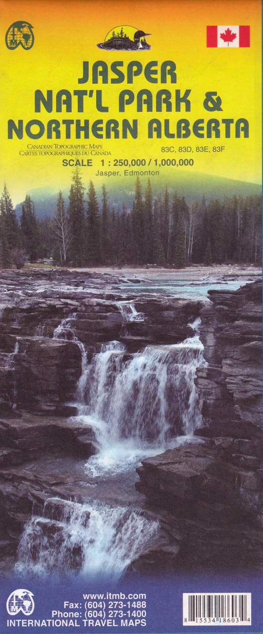
Description
🏔️ Jasper National Park & Northern Alberta Map – ITMB
Double-Sided Travel Map | Scale 1:250,000 / 1:1,000,000 | Size: 690 x 1000 mm | Optional Lamination Available
Discover one of Canada’s most dramatic contrasts in geography and climate with this two-in-one map from ITMB. On one side, explore the rugged alpine beauty of Jasper National Park in the Canadian Rockies. On the reverse, navigate the vast boreal expanse of Northern Alberta—a region of energy riches, extreme weather, and untamed wilderness.
🏞️ Side 1: Jasper National Park (Scale 1:250,000)
Nestled in the heart of the Alberta Rockies, Jasper National Park is the largest national park in the Canadian Rockies and a UNESCO World Heritage Site. This detailed map captures the park’s wild alpine terrain and includes:
-
🏔️ Major peaks, glaciers, and ridgelines
-
🛣️ The Icefields Parkway and Trans-Canada Highway
-
🥾 Hiking trails and campgrounds
-
🦌 Wildlife viewing zones and scenic viewpoints
-
🗺️ Detailed insets of Jasper townsite and surrounding access points
Whether you're planning a road trip, a multi-day hike, or wildlife photography expedition, this map is your gateway to one of Canada’s most awe-inspiring national parks.
🌲 Side 2: Northern Alberta (Scale 1:1,000,000)
This expansive map reveals the vast and remote wilderness of Northern Alberta, stretching from the central boreal forest to the borders of the Northwest Territories. Key features include:
-
🛣️ Full regional road network and secondary highways
-
🏙️ Key towns and cities such as Fort McMurray, Edmonton, and Grande Prairie
-
🌐 Energy resource areas including oil sands zones
-
🌳 Provincial parks, lakes, rivers, and recreation areas
-
🧭 Insets of Edmonton and Fort McMurray for urban orientation
This side of the map is ideal for industrial, environmental, and recreational use, and is perfect for travellers heading to Wood Buffalo National Park, oil sands routes, or exploring backcountry Alberta.
📌 Map Features
| Feature | Details |
|---|---|
| Format | Folded, double-sided map |
| Scales | 1:250,000 (Jasper) / 1:1,000,000 (Northern Alberta) |
| Size | 690 mm x 1000 mm |
| Insets | Jasper townsite & Edmonton city |
| Points of Interest | Parks, trails, roads, rivers, lakes, and energy zones |
| Road Detail | Highways, scenic routes, secondary roads, access tracks |
| Topography | Relief shading, forest cover, rivers and lakes |
💧 Optional Lamination
Upgrade your map with durable lamination:
-
✅ Write on it with whiteboard markers
-
✅ Apply removable map dots for planning
-
✅ Water-resistant, tear-resistant, easy to clean
Note: Laminated versions are created by flattening and encapsulating the folded map in 80-micron gloss laminate. Slight fold lines will still be visible beneath the laminate.
🎯 Perfect For:
-
🚙 Driving the Icefields Parkway or Highway 63 to Fort McMurray
-
🥾 Hikers, climbers, and wildlife lovers visiting Jasper
-
🛢️ Resource sector professionals needing a practical map of Northern Alberta
-
🎒 Adventure travellers seeking untamed Canadian landscapes
Whether you're tracking moose through the alpine meadows of Jasper or navigating northern oilfield routes, this ITMB double-sided map is the ideal companion for planning and exploration.