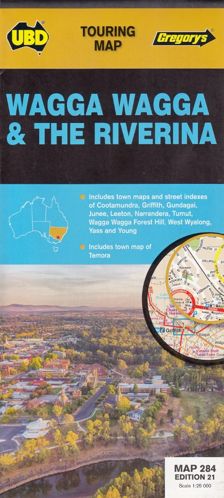
New South Wales State & Suburban UBD Map 270
UBD New South Wales & Greater Sydney Double-Sided Laminated Wall Map – 2023 Edition
Comprehensive state and metropolitan coverage in one durable, easy-to-use format – perfect for offices, classrooms, logistics, and planning
This double-sided laminated map by UBD offers a highly detailed and functional overview of both New South Wales and the Greater Sydney metropolitan area, making it an ideal resource for a wide range of uses—from corporate logistics and government planning to education, real estate, and personal navigation.
Published in 2023, this edition combines UBD’s trusted cartographic precision with a clean, user-friendly layout, and the added durability of full lamination. Whether you’re mapping freight routes, managing postal zones, plotting travel itineraries, or studying the urban and regional geography of NSW, this map delivers clarity, detail, and practicality in one versatile package.
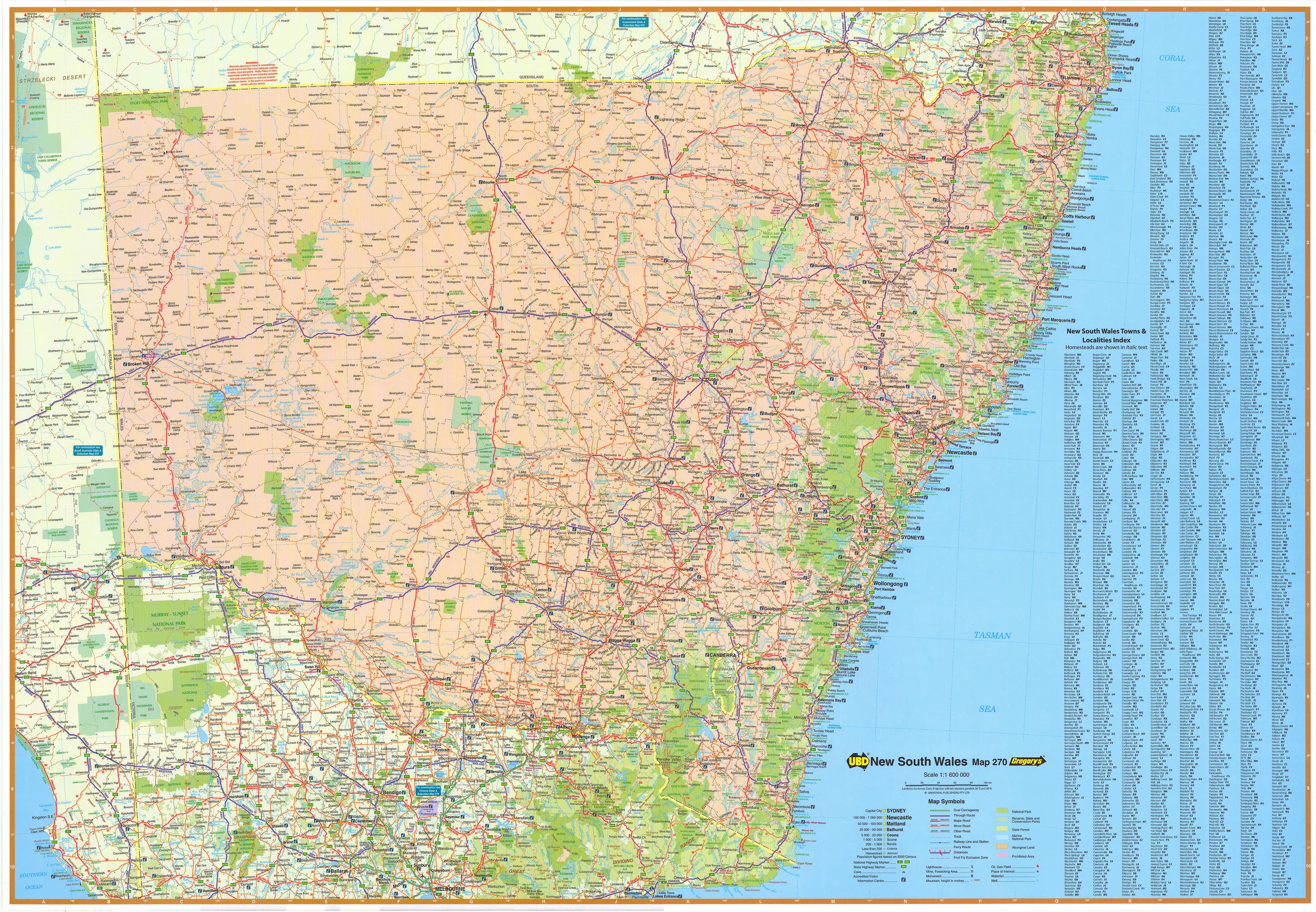
🗺️ Side One – New South Wales State Map (Scale 1:1,600,000)
Designed for regional overview and long-distance planning, the front of the map offers comprehensive coverage of New South Wales, including:
-
Major highways, motorways, and dual carriageways
-
National highways and state routes clearly identified
-
Detailed regional town and locality names, all fully indexed
-
Accurate representation of national parks, nature reserves, rivers, lakes, and other major geographical features
-
Clear differentiation between urban, rural, and wilderness zones
-
Suitable for fleet management, regional delivery networks, route planning, and more
Whether you’re a courier plotting efficient routes, a student learning about the state's geography, or a traveller planning the perfect road trip, this side of the map offers the full-scale reference needed to understand NSW at a glance.
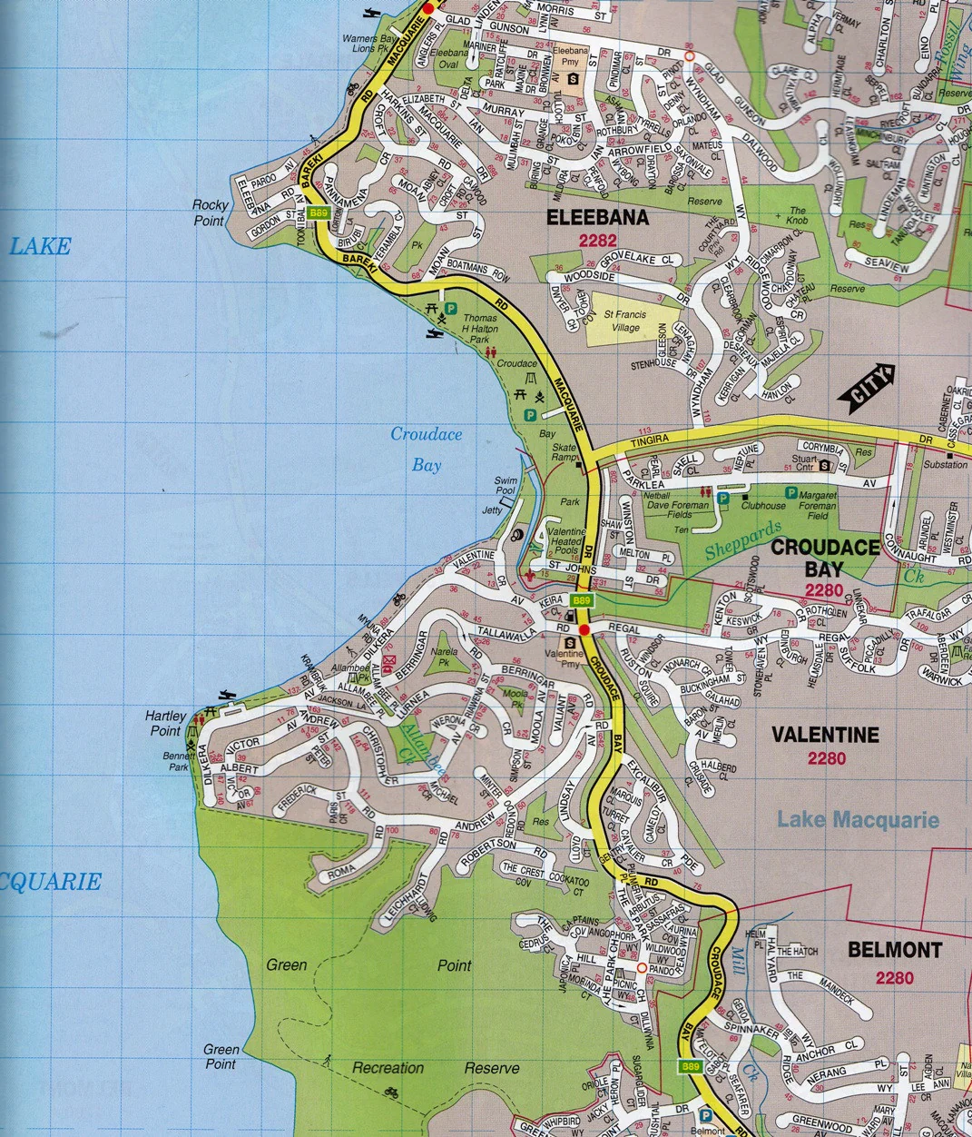
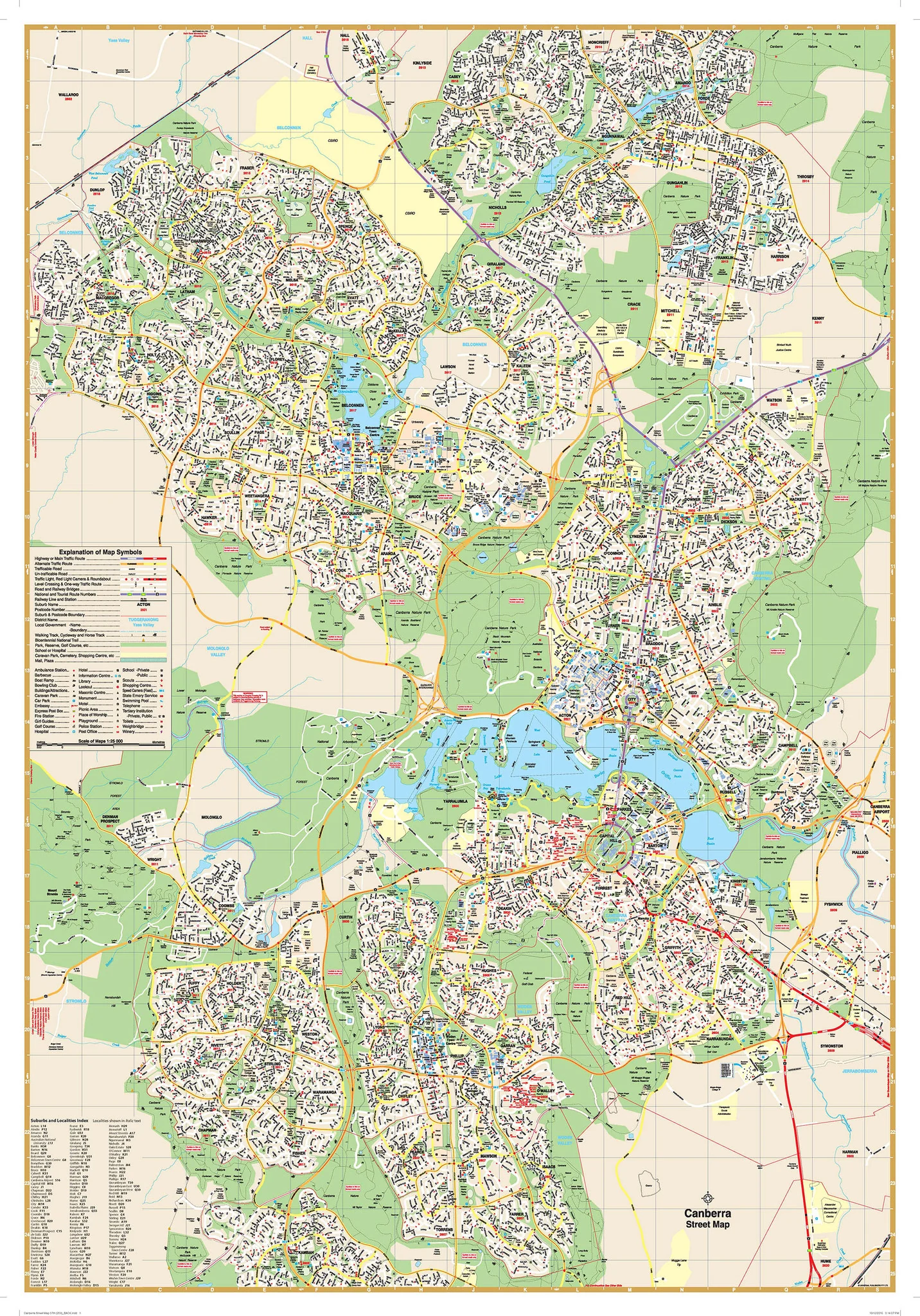
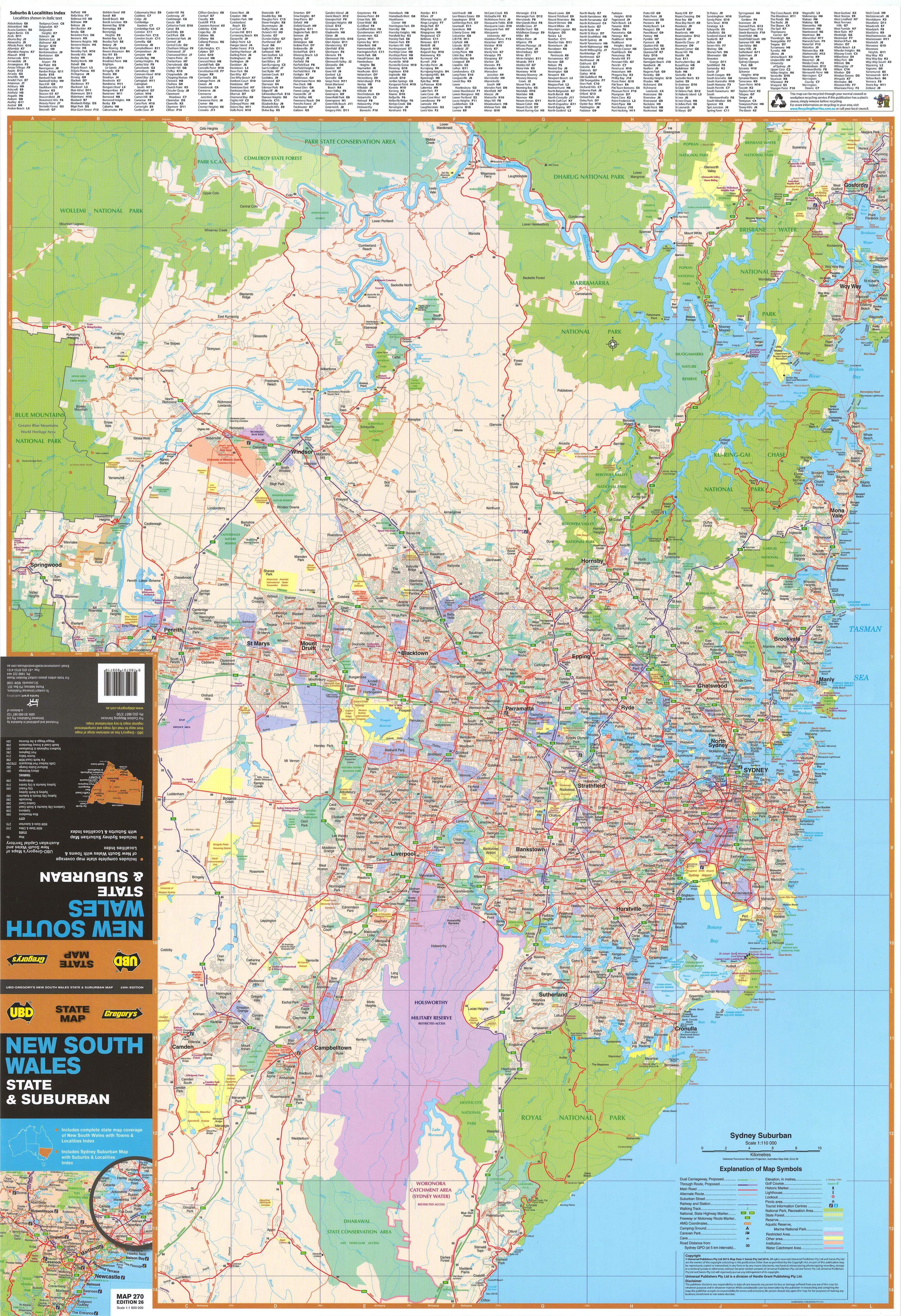
🌆 Side Two – Greater Sydney Suburban Map (Scale 1:110,000)
The reverse side zooms into Sydney’s suburban sprawl, offering a detailed view of the entire metropolitan region, including:
-
Coverage from Gosford in the north, Clifton in the south, and as far west as Springwood in the Blue Mountains
-
Arterial roads, major connectors, and industrial zones clearly marked for ease of navigation
-
Suburban areas clearly shaded to show built-up regions
-
All Sydney suburbs named and labelled, complete with postcode identifiers
-
Comprehensive index of all suburbs for easy cross-reference
-
Key landmarks, infrastructure, parks, and waterways included
This side is ideal for urban service planning, franchise management, real estate professionals, or anyone who needs to understand postal boundaries, commuter routes, and urban infrastructure across Sydney’s expansive metro area.
📐 Map Specifications:
-
Size: 700 mm wide x 1000 mm high
-
Scale:
-
Front (NSW): 1:1,600,000
-
Reverse (Sydney): 1:110,000
-
-
Published: 2023
-
Publisher: UBD Gregory's, Australia's most trusted mapmaker
-
Material: Printed on quality map stock and encapsulated in high-gloss laminate
🛠️ Laminated Format Options:
✅ Option 1 – Flat Laminated Map – $99.00
-
Professionally laminated and delivered flat (no folds)
-
Ideal for display on walls in offices, classrooms, or home studies
-
Writable and erasable with whiteboard markers — perfect for presentations, planning, and tracking
✅ Option 2 – Laminated Previously Folded Map – $49.95
-
Cost-effective version with light crease lines from original folds
-
Still fully laminated and usable with whiteboard markers
-
Great for casual use or budget-conscious buyers
🧭 Perfect For:
-
Government departments and councils managing urban development and regional services
-
Businesses needing to visualise territories, logistics, and service zones
-
Real estate agencies and franchise operations looking to visualise suburb boundaries and postcodes
-
Classrooms and universities teaching Australian geography and planning
-
Travellers and drivers planning trips within NSW or around Sydney
-
Home offices looking for a functional and informative decorative piece
Whether you’re working, learning, or exploring, the UBD Double-Sided NSW & Sydney Map (2023 Edition) is an exceptional resource — giving you both the macro and micro view of Australia’s most populous state and its iconic capital.
Get the full picture. Plan, teach, and navigate with confidence — with UBD’s trusted wall map at your side.
Original: $13.95
-70%$13.95
$4.18
Description
UBD New South Wales & Greater Sydney Double-Sided Laminated Wall Map – 2023 Edition
Comprehensive state and metropolitan coverage in one durable, easy-to-use format – perfect for offices, classrooms, logistics, and planning
This double-sided laminated map by UBD offers a highly detailed and functional overview of both New South Wales and the Greater Sydney metropolitan area, making it an ideal resource for a wide range of uses—from corporate logistics and government planning to education, real estate, and personal navigation.
Published in 2023, this edition combines UBD’s trusted cartographic precision with a clean, user-friendly layout, and the added durability of full lamination. Whether you’re mapping freight routes, managing postal zones, plotting travel itineraries, or studying the urban and regional geography of NSW, this map delivers clarity, detail, and practicality in one versatile package.
🗺️ Side One – New South Wales State Map (Scale 1:1,600,000)
Designed for regional overview and long-distance planning, the front of the map offers comprehensive coverage of New South Wales, including:
-
Major highways, motorways, and dual carriageways
-
National highways and state routes clearly identified
-
Detailed regional town and locality names, all fully indexed
-
Accurate representation of national parks, nature reserves, rivers, lakes, and other major geographical features
-
Clear differentiation between urban, rural, and wilderness zones
-
Suitable for fleet management, regional delivery networks, route planning, and more
Whether you’re a courier plotting efficient routes, a student learning about the state's geography, or a traveller planning the perfect road trip, this side of the map offers the full-scale reference needed to understand NSW at a glance.
🌆 Side Two – Greater Sydney Suburban Map (Scale 1:110,000)
The reverse side zooms into Sydney’s suburban sprawl, offering a detailed view of the entire metropolitan region, including:
-
Coverage from Gosford in the north, Clifton in the south, and as far west as Springwood in the Blue Mountains
-
Arterial roads, major connectors, and industrial zones clearly marked for ease of navigation
-
Suburban areas clearly shaded to show built-up regions
-
All Sydney suburbs named and labelled, complete with postcode identifiers
-
Comprehensive index of all suburbs for easy cross-reference
-
Key landmarks, infrastructure, parks, and waterways included
This side is ideal for urban service planning, franchise management, real estate professionals, or anyone who needs to understand postal boundaries, commuter routes, and urban infrastructure across Sydney’s expansive metro area.
📐 Map Specifications:
-
Size: 700 mm wide x 1000 mm high
-
Scale:
-
Front (NSW): 1:1,600,000
-
Reverse (Sydney): 1:110,000
-
-
Published: 2023
-
Publisher: UBD Gregory's, Australia's most trusted mapmaker
-
Material: Printed on quality map stock and encapsulated in high-gloss laminate
🛠️ Laminated Format Options:
✅ Option 1 – Flat Laminated Map – $99.00
-
Professionally laminated and delivered flat (no folds)
-
Ideal for display on walls in offices, classrooms, or home studies
-
Writable and erasable with whiteboard markers — perfect for presentations, planning, and tracking
✅ Option 2 – Laminated Previously Folded Map – $49.95
-
Cost-effective version with light crease lines from original folds
-
Still fully laminated and usable with whiteboard markers
-
Great for casual use or budget-conscious buyers
🧭 Perfect For:
-
Government departments and councils managing urban development and regional services
-
Businesses needing to visualise territories, logistics, and service zones
-
Real estate agencies and franchise operations looking to visualise suburb boundaries and postcodes
-
Classrooms and universities teaching Australian geography and planning
-
Travellers and drivers planning trips within NSW or around Sydney
-
Home offices looking for a functional and informative decorative piece
Whether you’re working, learning, or exploring, the UBD Double-Sided NSW & Sydney Map (2023 Edition) is an exceptional resource — giving you both the macro and micro view of Australia’s most populous state and its iconic capital.
Get the full picture. Plan, teach, and navigate with confidence — with UBD’s trusted wall map at your side.