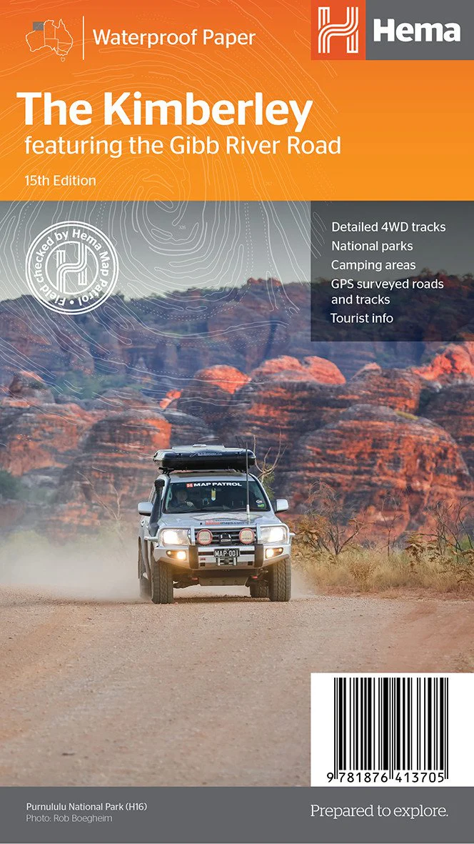
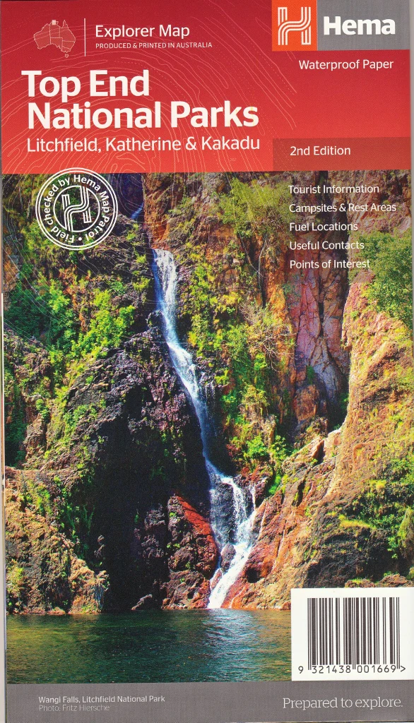
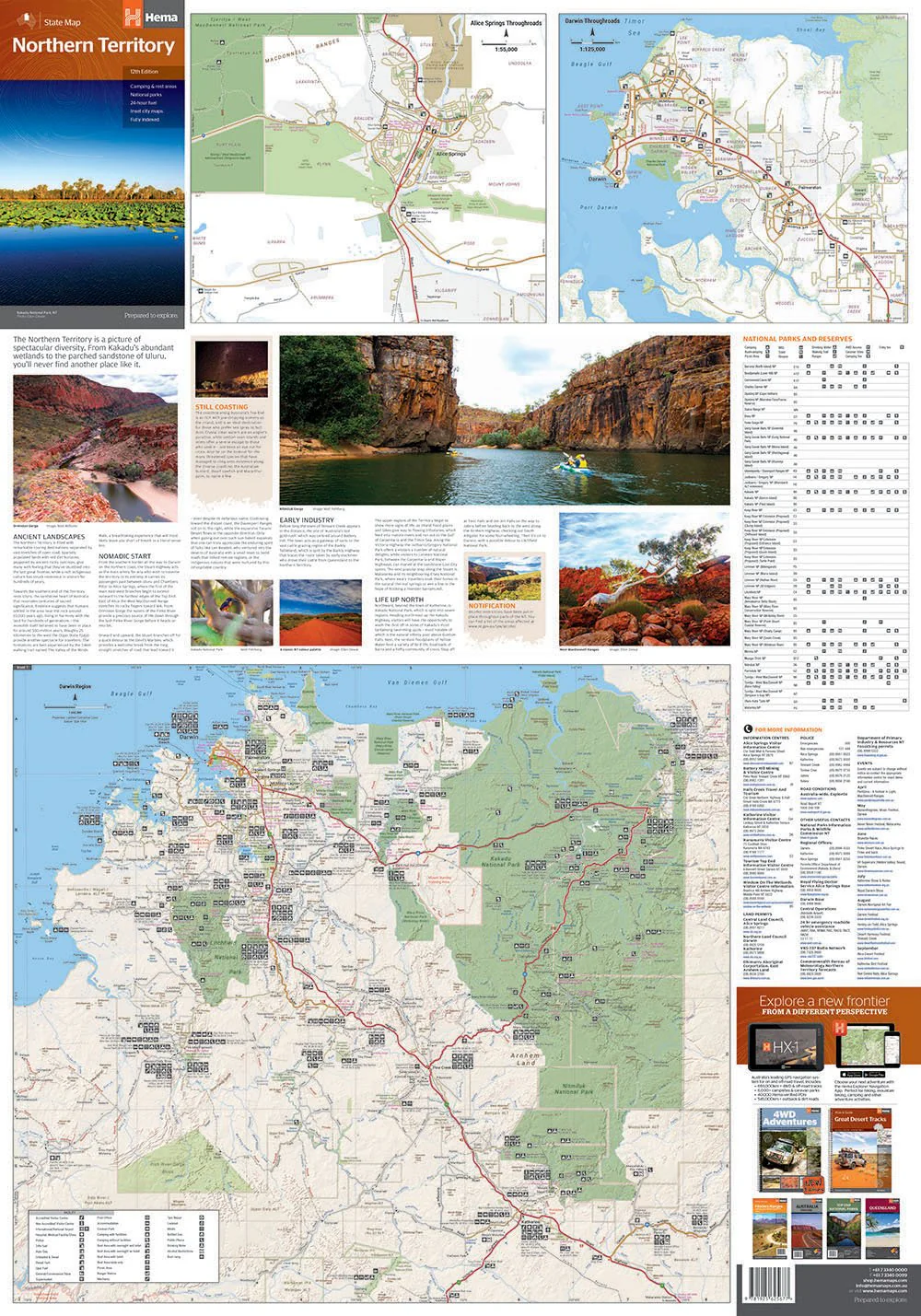
Northern Territory Hema State Map – 12th Edition
Waterproof Touring Map | 4WD Tracks, National Parks & Campsites | Explore the Heart of Australia
Discover the rugged heart of Australia with confidence using the Hema Northern Territory State Map, now in its 12th edition. Designed by Australia’s most trusted map publisher, this map is your essential companion for road trips, 4WD adventures, camping expeditions, and remote touring across one of the country's most iconic and untamed regions.
Whether you're planning a cross-territory expedition, navigating the Red Centre, or exploring the Top End’s waterfalls and wetlands, this map combines detailed cartography with practical travel insights. It's a must-have for any adventurer, planner, or outback enthusiast.
🌟 Why Choose This Map?
-
Trusted by Explorers – Produced by Hema Maps, Australia's leading authority in touring and adventure mapping.
-
Built for the Outback – Printed on tear-resistant and waterproof paper to survive tough travel conditions.
-
Comprehensive Coverage – Includes everything from sealed highways to remote 4WD tracks.
-
Touring Ready – Features fuel stops, campsites, rest areas, distances, and major outback attractions.
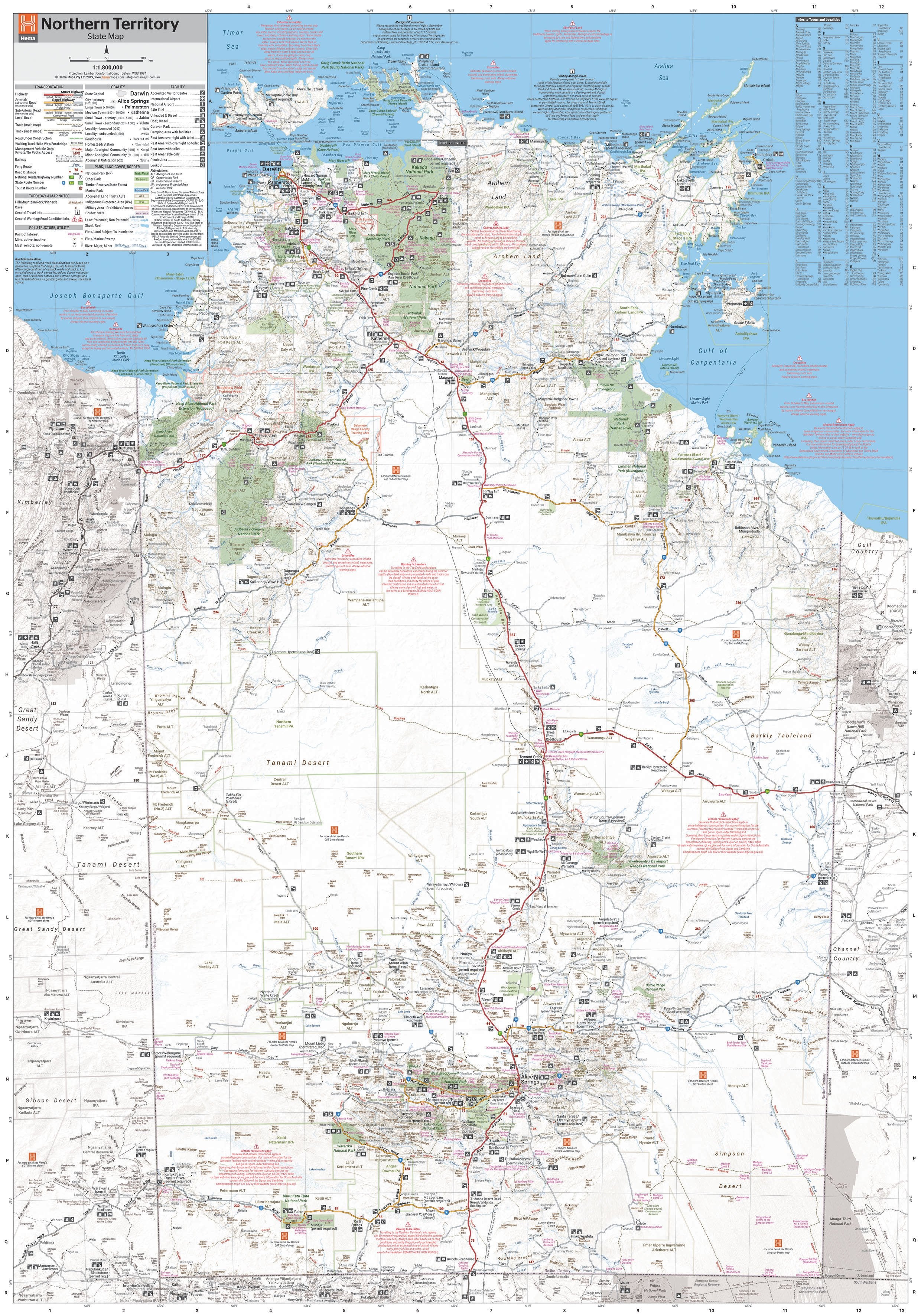
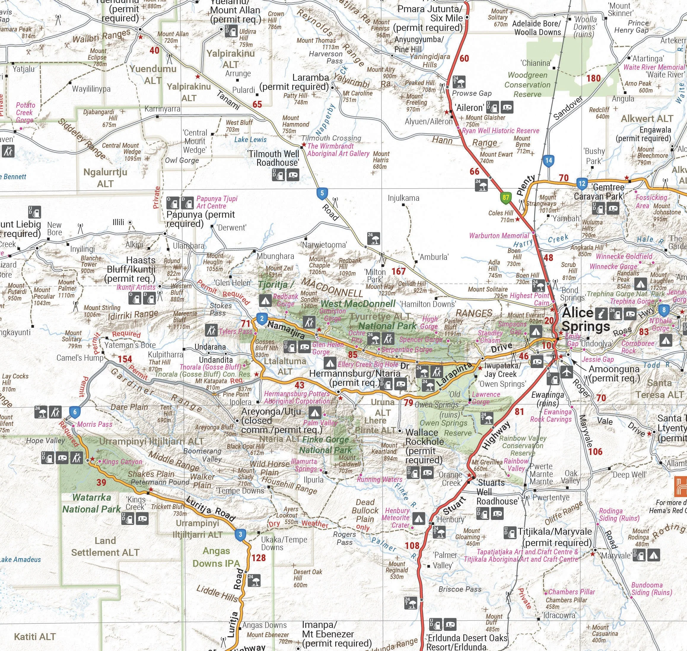
🗺️ What’s On the Map?
-
🛣️ Extensive Road Networks – Clear detail on major highways, minor roads, and 4WD-only tracks, including GPS-surveyed data.
-
⛽ 24-Hour Fuel Locations – Plan your fuel stops carefully in remote country.
-
🏕️ Camping & Rest Areas – Ideal for caravanners and campers, including free and paid sites.
-
🧭 Points of Interest – Includes historical sites, lookouts, Indigenous cultural sites, and natural wonders.
-
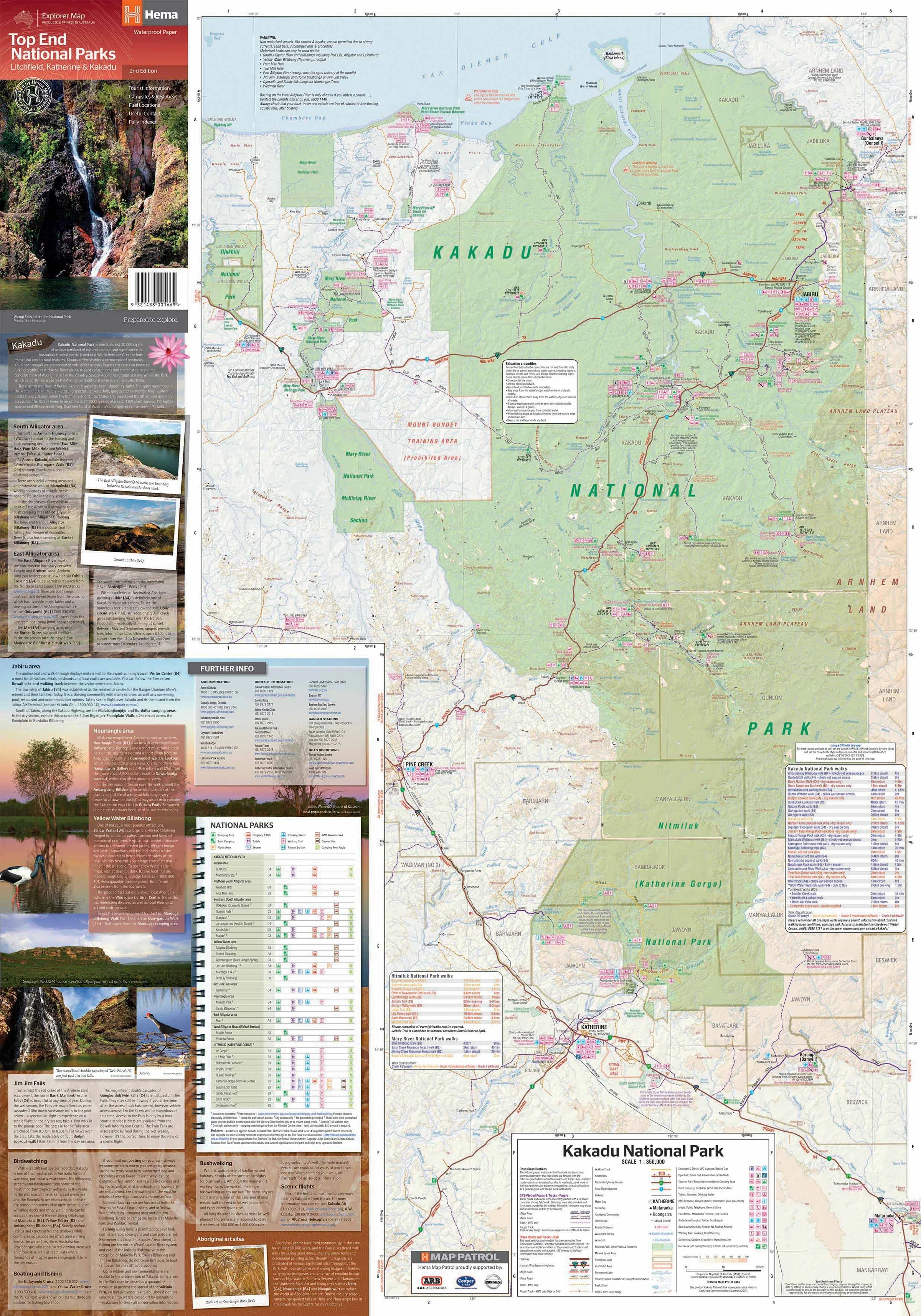
🏞️ National Parks Matrix – Lists key access details, facilities, and contact info for parks across the Territory.
-
🏙️ City Insets – Enlarged, detailed maps of:
-
Darwin
-
Alice Springs
-
Yulara & Uluru
-
Kata Tjuta / The Olgas
-
Litchfield & Kakadu Region Highlights
-
📐 Specifications
| Feature | Details |
|---|---|
| Edition | 12th Edition |
| Published | October 2019 |
| Scale | 1:1,800,000 |
| Unfolded Size | 1000 mm (W) × 700 mm (H) |
| Folded Size | 250 mm × 140 mm |
| Material | Waterproof, tear-resistant stock |
| Weight | Approx. 90 grams |
| Publisher | Hema Maps |
🧳 Perfect For
-
🚙 4WD Explorers – Navigate remote tracks with detailed and field-checked data
-
🏕️ Campers & Grey Nomads – Find your next rest stop, bush campsite, or caravan park
-
🛻 Outback Road Trippers – Plan epic drives through the Red Centre or across the Barkly Tableland
-
🧑🏫 Educators & Tour Guides – Use as a visual aid for understanding geography and ecology of the NT
-
🧭 Emergency Planners – A valuable backup navigation resource for remote area safety
🛍️ Available Formats
-
Folded Map – Compact and easy to carry in your glove box, backpack, or travel binder.
Pre-Folded-Laminated Map – $49.95 (Economy Edition)
Laminated after flattening a previously folded map. Functionally identical, but with faint fold lines remaining. An excellent value option for everyday practical use, caravans, fieldwork, or classrooms.
📦 Shipping & Support
-
✅ Ships rolled or folded (depending on finish)
-
🌏 Australia-wide and international delivery available
-
🎁 Makes a perfect gift for travellers, overlanders, or anyone preparing a big Aussie road trip
🧭 Go Further, Explore Deeper
From the red sands of the Simpson Desert to the waterfalls of Kakadu and the cultural centres of Alice Springs and Darwin, the Hema Northern Territory Map gives you the insight and information you need to plan confidently, travel safely, and make the most of every kilometre.
Add it to your cart today, and take the Northern Territory into your own hands.
Original: $14.95
-70%$14.95
$4.48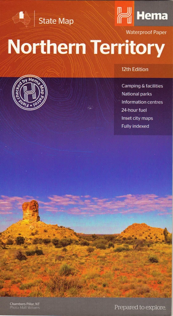
Description
Waterproof Touring Map | 4WD Tracks, National Parks & Campsites | Explore the Heart of Australia
Discover the rugged heart of Australia with confidence using the Hema Northern Territory State Map, now in its 12th edition. Designed by Australia’s most trusted map publisher, this map is your essential companion for road trips, 4WD adventures, camping expeditions, and remote touring across one of the country's most iconic and untamed regions.
Whether you're planning a cross-territory expedition, navigating the Red Centre, or exploring the Top End’s waterfalls and wetlands, this map combines detailed cartography with practical travel insights. It's a must-have for any adventurer, planner, or outback enthusiast.
🌟 Why Choose This Map?
-
Trusted by Explorers – Produced by Hema Maps, Australia's leading authority in touring and adventure mapping.
-
Built for the Outback – Printed on tear-resistant and waterproof paper to survive tough travel conditions.
-
Comprehensive Coverage – Includes everything from sealed highways to remote 4WD tracks.
-
Touring Ready – Features fuel stops, campsites, rest areas, distances, and major outback attractions.
🗺️ What’s On the Map?
-
🛣️ Extensive Road Networks – Clear detail on major highways, minor roads, and 4WD-only tracks, including GPS-surveyed data.
-
⛽ 24-Hour Fuel Locations – Plan your fuel stops carefully in remote country.
-
🏕️ Camping & Rest Areas – Ideal for caravanners and campers, including free and paid sites.
-
🧭 Points of Interest – Includes historical sites, lookouts, Indigenous cultural sites, and natural wonders.
-
🏞️ National Parks Matrix – Lists key access details, facilities, and contact info for parks across the Territory.
-
🏙️ City Insets – Enlarged, detailed maps of:
-
Darwin
-
Alice Springs
-
Yulara & Uluru
-
Kata Tjuta / The Olgas
-
Litchfield & Kakadu Region Highlights
-
📐 Specifications
| Feature | Details |
|---|---|
| Edition | 12th Edition |
| Published | October 2019 |
| Scale | 1:1,800,000 |
| Unfolded Size | 1000 mm (W) × 700 mm (H) |
| Folded Size | 250 mm × 140 mm |
| Material | Waterproof, tear-resistant stock |
| Weight | Approx. 90 grams |
| Publisher | Hema Maps |
🧳 Perfect For
-
🚙 4WD Explorers – Navigate remote tracks with detailed and field-checked data
-
🏕️ Campers & Grey Nomads – Find your next rest stop, bush campsite, or caravan park
-
🛻 Outback Road Trippers – Plan epic drives through the Red Centre or across the Barkly Tableland
-
🧑🏫 Educators & Tour Guides – Use as a visual aid for understanding geography and ecology of the NT
-
🧭 Emergency Planners – A valuable backup navigation resource for remote area safety
🛍️ Available Formats
-
Folded Map – Compact and easy to carry in your glove box, backpack, or travel binder.
Pre-Folded-Laminated Map – $49.95 (Economy Edition)
Laminated after flattening a previously folded map. Functionally identical, but with faint fold lines remaining. An excellent value option for everyday practical use, caravans, fieldwork, or classrooms.
📦 Shipping & Support
-
✅ Ships rolled or folded (depending on finish)
-
🌏 Australia-wide and international delivery available
-
🎁 Makes a perfect gift for travellers, overlanders, or anyone preparing a big Aussie road trip
🧭 Go Further, Explore Deeper
From the red sands of the Simpson Desert to the waterfalls of Kakadu and the cultural centres of Alice Springs and Darwin, the Hema Northern Territory Map gives you the insight and information you need to plan confidently, travel safely, and make the most of every kilometre.
Add it to your cart today, and take the Northern Territory into your own hands.