Cape York Hema 700 x 1000mm Laminated Wall Map
Size: 1000 mm (W) x 700 mm (H) | Scale: 1:1,000,000 | Waterproof & Durable
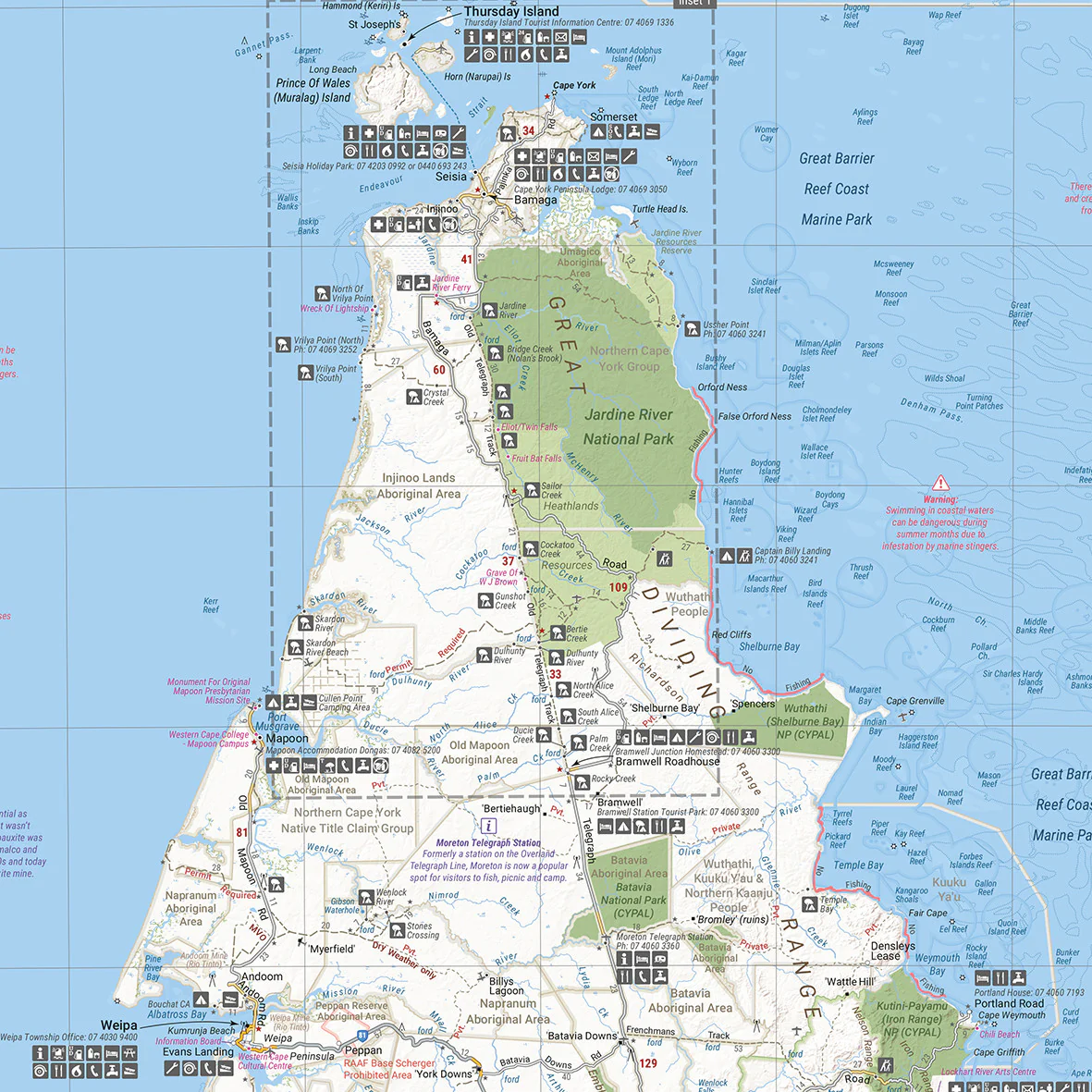
The Ultimate 4WD Map for Cape York
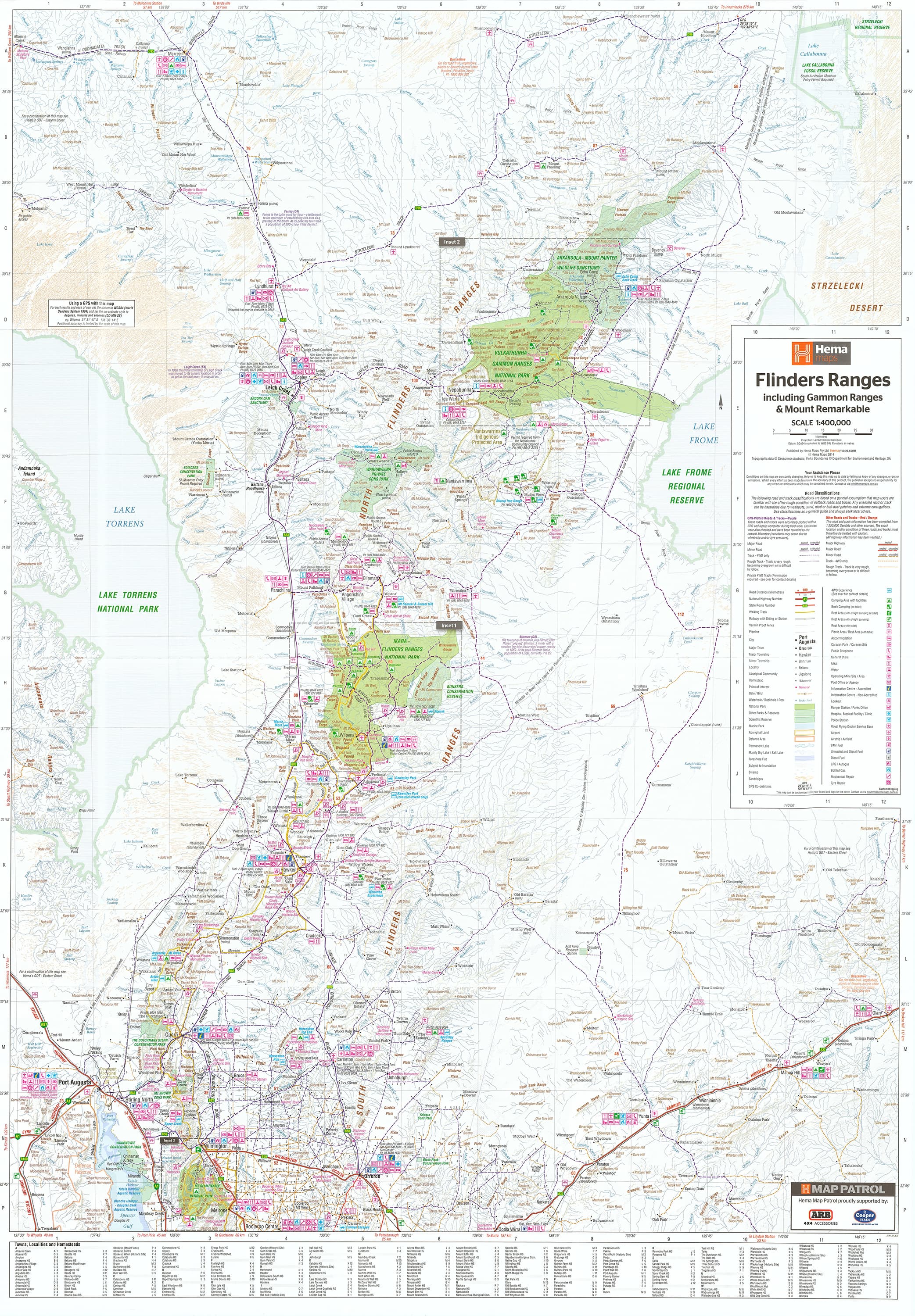
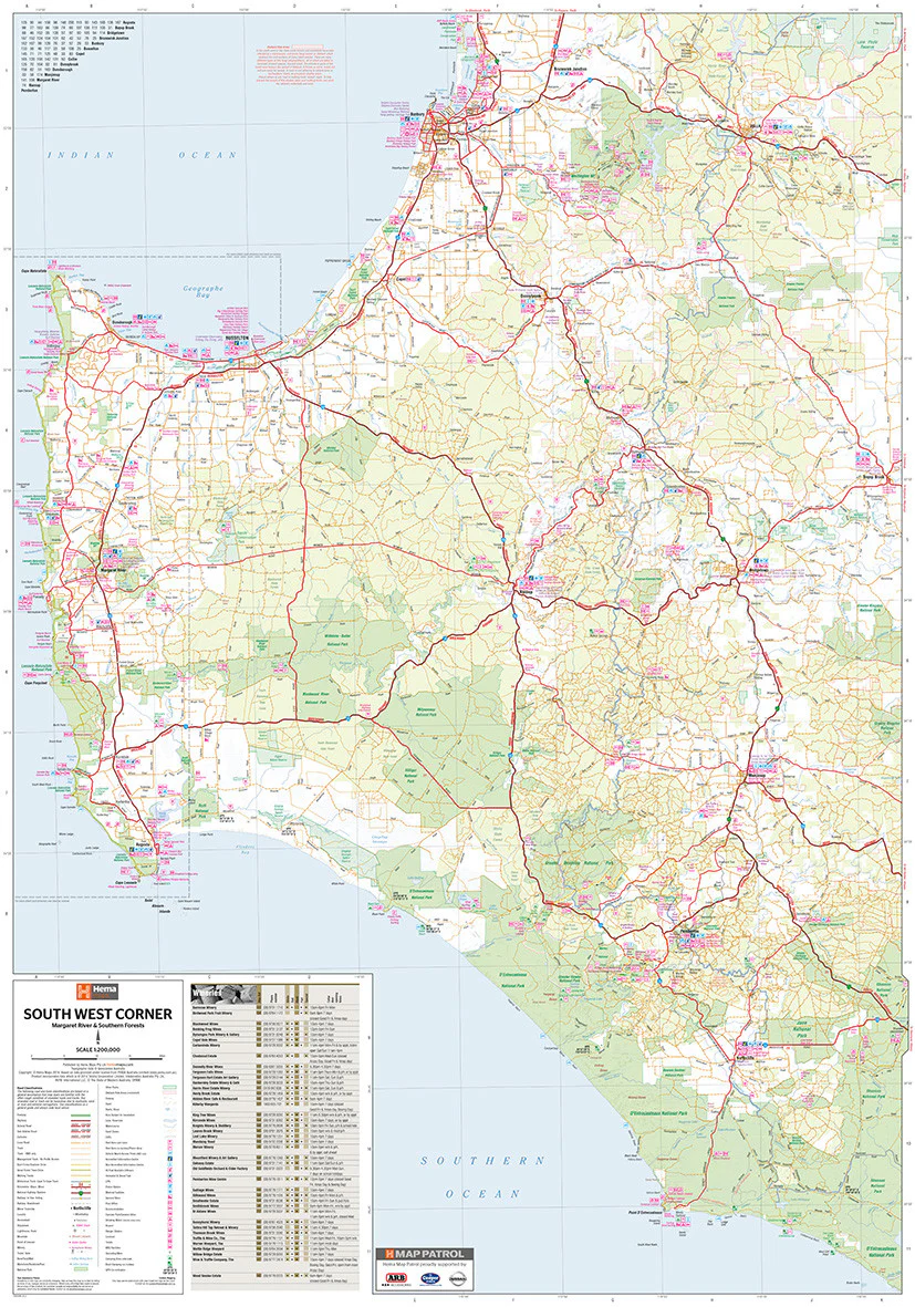
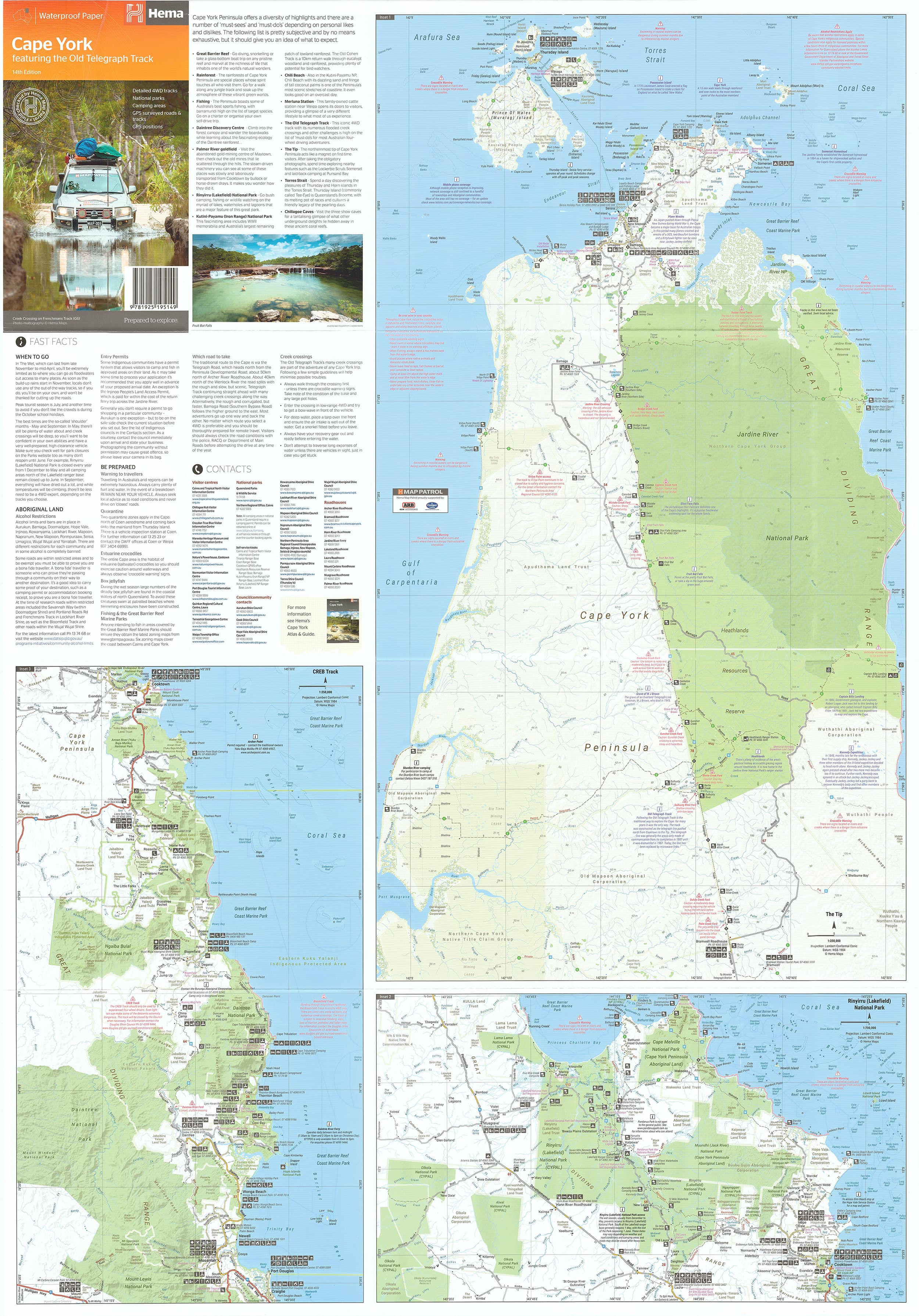
This Cape York Laminated Wall Map by Hema Maps is a must-have for anyone planning to tackle one of Australia’s most iconic off-road journeys—The Old Telegraph Track. This detailed, full-colour wall map covers the entire Cape York Peninsula, a region rich in rugged adventure, pristine wilderness, and remote cultural heritage.
With its 1:1,000,000 scale, this map strikes the perfect balance between regional overview and on-ground navigation—ideal for trip planning, classroom reference, business walls or garage display.
Key Map Features
| Feature | Description |
|---|---|
| 🛰️ GPS Markers | Grid references and GPS coordinates for key points |
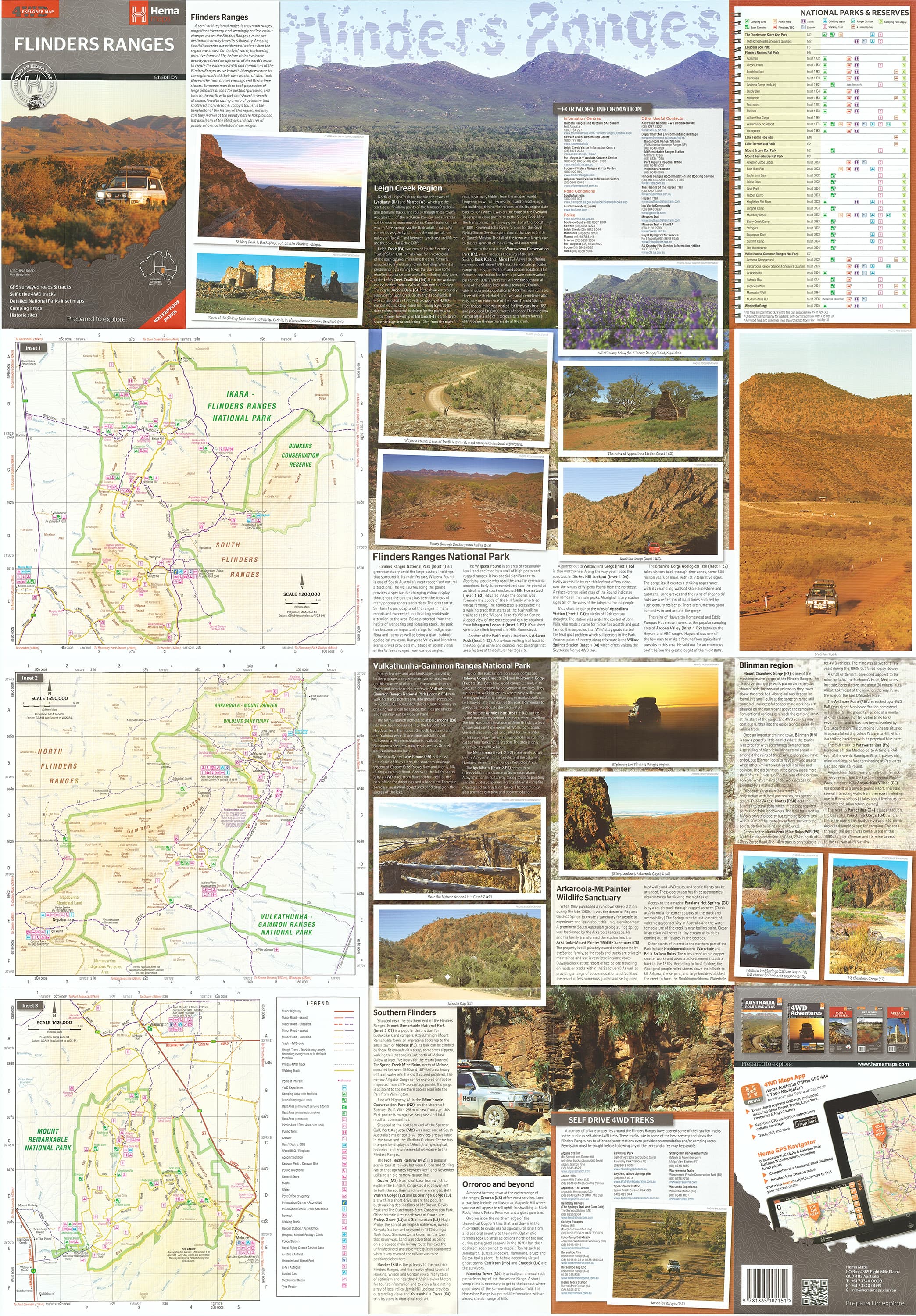
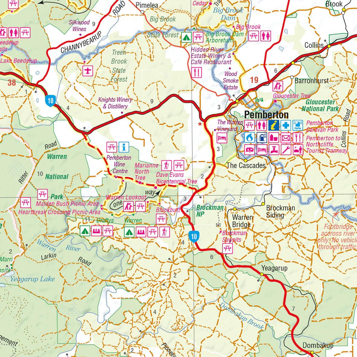
| 🧭 Old Telegraph Track | Dedicated inset map detailing this legendary 4WD route |
| ⛺ Camping Areas | Designated campsites and bush camping zones clearly marked |
| 🌳 National Parks | Fully outlined, with names and boundaries shown |
| 💻 Digital Cartography | Updated with the latest geographic and road data from Hema |
Map Specifications
| Specification | Detail |
|---|---|
| Brand | Hema Maps |
| Format | Laminated Wall Map |
| Opened Size | 1000 mm (W) x 700 mm (H) |
| Scale | 1:1,000,000 |
| Pigment-based inks on 120 gsm FSC matte-coated paper | |
| Lamination | Fully encapsulated with 80-micron gloss laminate |
Why Choose This Map?
-
Authoritative detail from Hema’s GPS-surveyed mapping database
-
Perfect for Cape York expedition planning—from Cairns to the Tip
-
Campsites, 4WD tracks, and access roads all marked clearly
-
Laminated for reusability – write with whiteboard marker or use map dots to highlight key stops
-
Tear-resistant and waterproof, ideal for outdoor and vehicle use
Ideal For:
-
4WD trip planning
-
Educational displays
-
Travel agencies or adventure tour offices
-
Garage walls, adventure planning rooms or classrooms
📦 Note: This map has been professionally flattened from its original folded form before lamination. As a result, some subtle crease lines may remain visible—but its functionality and presentation are not affected.
Made in Australia 🇦🇺
Published by Hema Maps
Map Edition: Latest Available
🛒 Ready to hit the Old Tele Track or planning a Cape adventure? Let this Hema map be your trusted guide from start to finish.
Original: $49.95
-70%$49.95
$14.98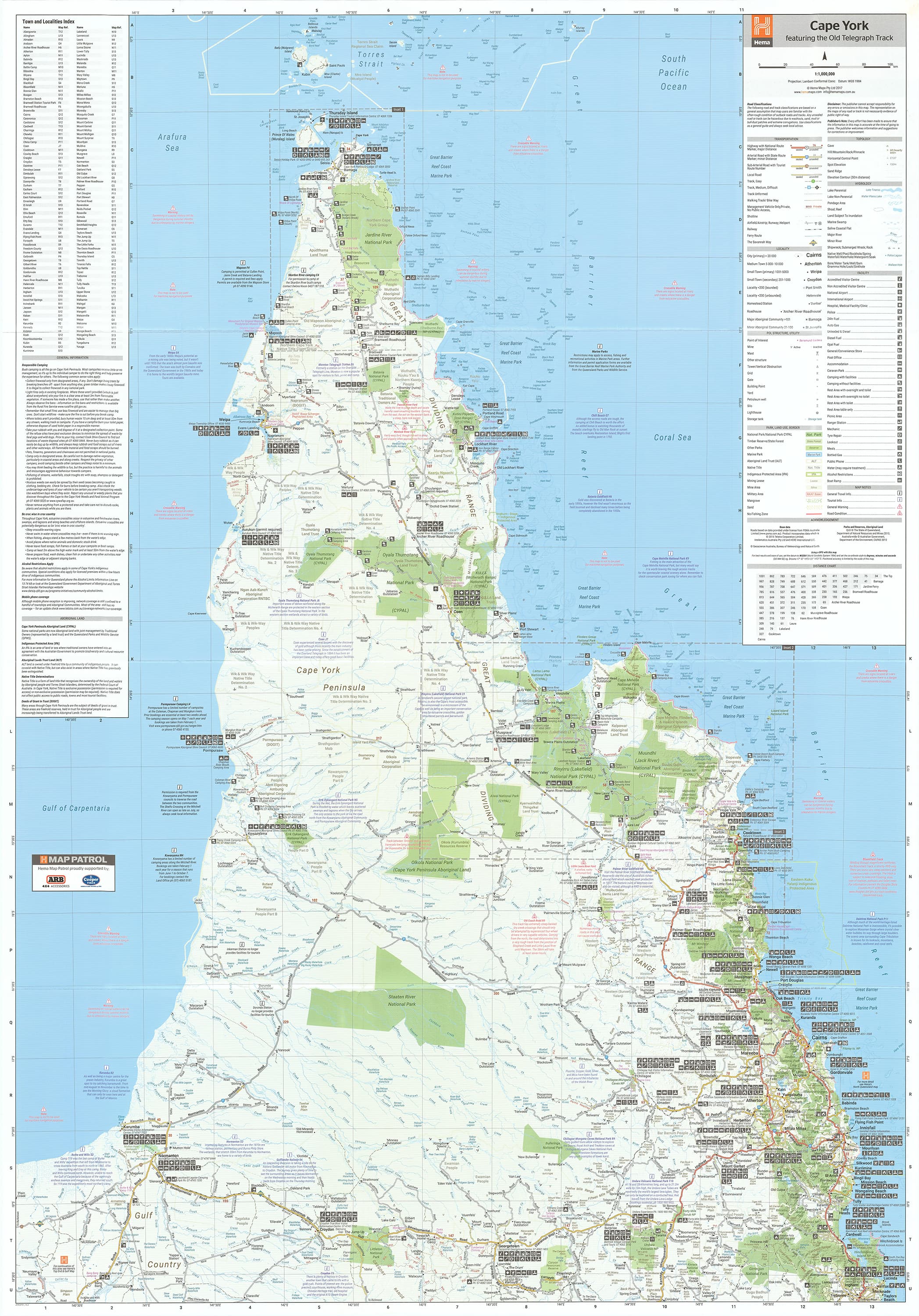
Description
Size: 1000 mm (W) x 700 mm (H) | Scale: 1:1,000,000 | Waterproof & Durable
The Ultimate 4WD Map for Cape York
This Cape York Laminated Wall Map by Hema Maps is a must-have for anyone planning to tackle one of Australia’s most iconic off-road journeys—The Old Telegraph Track. This detailed, full-colour wall map covers the entire Cape York Peninsula, a region rich in rugged adventure, pristine wilderness, and remote cultural heritage.
With its 1:1,000,000 scale, this map strikes the perfect balance between regional overview and on-ground navigation—ideal for trip planning, classroom reference, business walls or garage display.
Key Map Features
| Feature | Description |
|---|---|
| 🛰️ GPS Markers | Grid references and GPS coordinates for key points |
| 🧭 Old Telegraph Track | Dedicated inset map detailing this legendary 4WD route |
| ⛺ Camping Areas | Designated campsites and bush camping zones clearly marked |
| 🌳 National Parks | Fully outlined, with names and boundaries shown |
| 💻 Digital Cartography | Updated with the latest geographic and road data from Hema |
Map Specifications
| Specification | Detail |
|---|---|
| Brand | Hema Maps |
| Format | Laminated Wall Map |
| Opened Size | 1000 mm (W) x 700 mm (H) |
| Scale | 1:1,000,000 |
| Pigment-based inks on 120 gsm FSC matte-coated paper | |
| Lamination | Fully encapsulated with 80-micron gloss laminate |
Why Choose This Map?
-
Authoritative detail from Hema’s GPS-surveyed mapping database
-
Perfect for Cape York expedition planning—from Cairns to the Tip
-
Campsites, 4WD tracks, and access roads all marked clearly
-
Laminated for reusability – write with whiteboard marker or use map dots to highlight key stops
-
Tear-resistant and waterproof, ideal for outdoor and vehicle use
Ideal For:
-
4WD trip planning
-
Educational displays
-
Travel agencies or adventure tour offices
-
Garage walls, adventure planning rooms or classrooms
📦 Note: This map has been professionally flattened from its original folded form before lamination. As a result, some subtle crease lines may remain visible—but its functionality and presentation are not affected.
Made in Australia 🇦🇺
Published by Hema Maps
Map Edition: Latest Available
🛒 Ready to hit the Old Tele Track or planning a Cape adventure? Let this Hema map be your trusted guide from start to finish.