Central Australia Hema 1000 x 700mm Laminated Wall Map
The Ultimate Wall Map for Outback Planning & Adventure
Scale: 1:2,000,000 | Size: 1000 mm (W) x 700 mm (H)
Laminated for durability | GPS-surveyed & packed with info
Overview
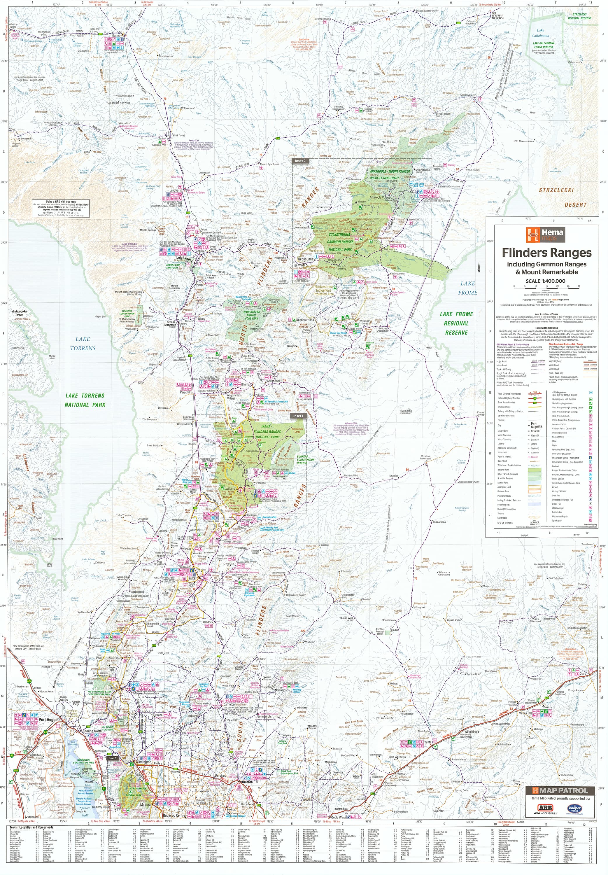
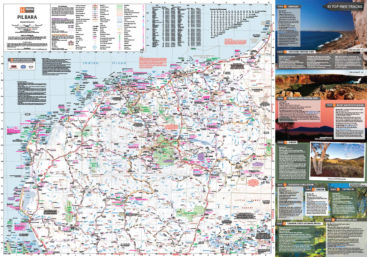
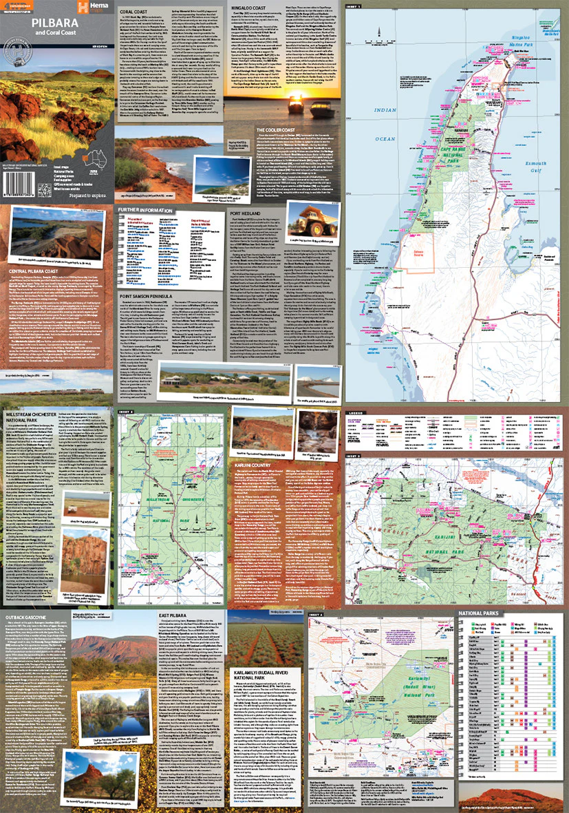
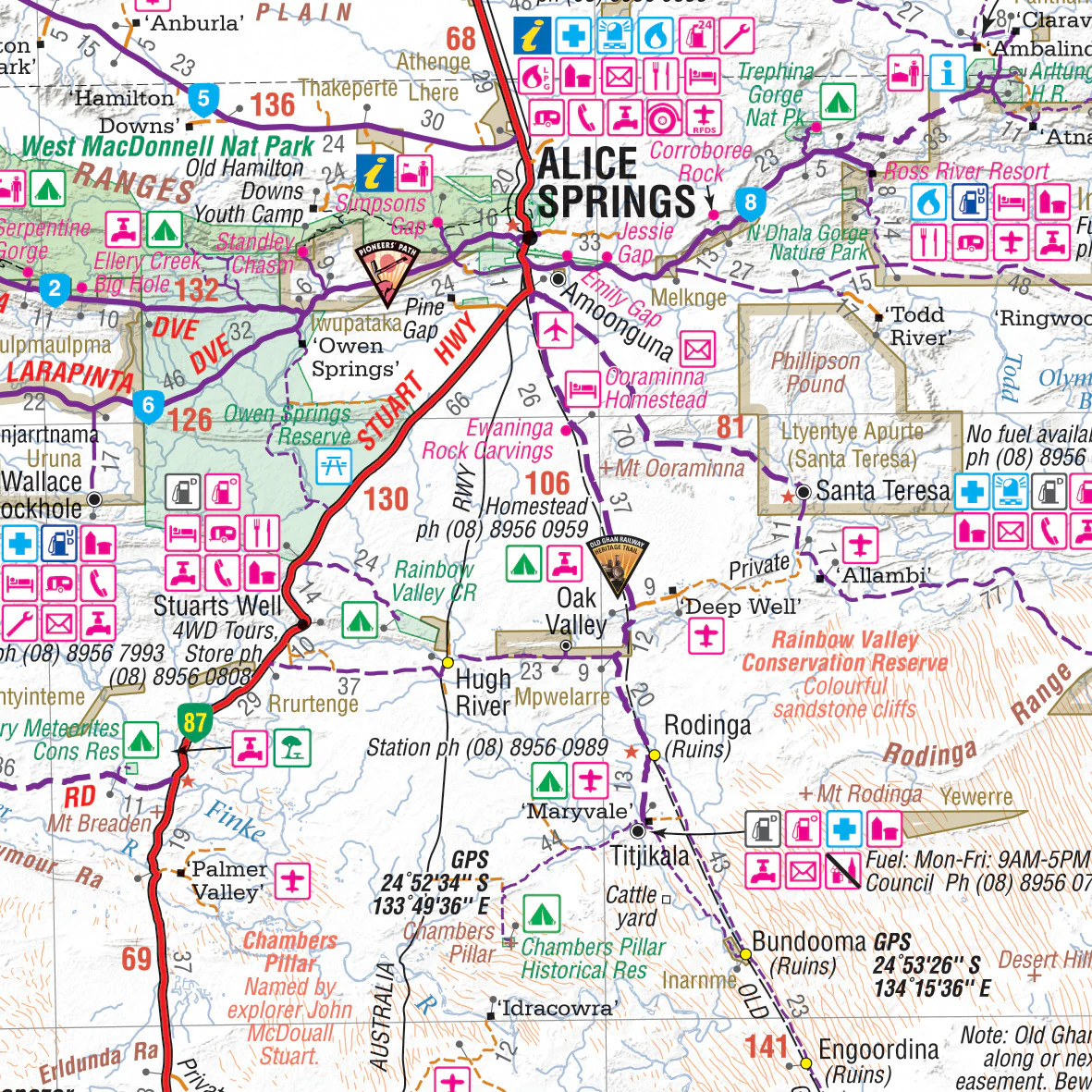
Navigate the vast and remote heart of the continent with confidence using the Central Australia Laminated Wall Map by Hema. Now more detailed and informative than ever, this updated edition combines GPS-accurate cartography with rich, travel-focused content—including text, photographs, and essential outback information.
Whether you're planning a 4WD trek along the Tanami Track, hunting down fuel stops in the Red Centre, or simply mapping out your journey across Australia’s most iconic landscapes, this wall map is your go-to reference. Its laminated surface allows for dry-erase planning and long-lasting use—perfect for explorers, tour planners, or armchair adventurers alike.
🗺️ Map Highlights
-
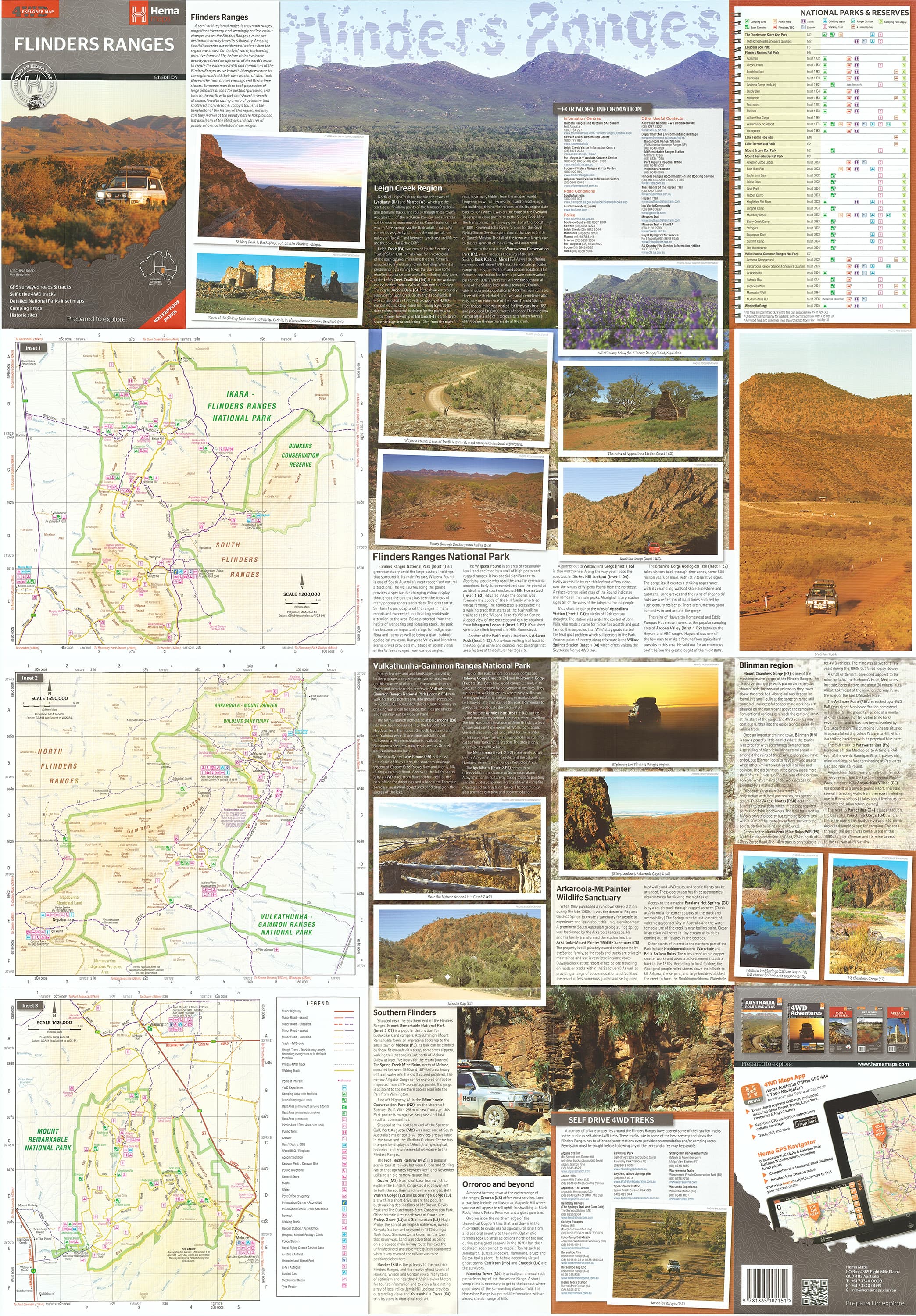
Newly added photos and descriptions of key destinations and travel routes
-
Inset map of the Tanami Track (North) – now covers the full length of the track
-
Hundreds of marked locations with latitude and longitude coordinates
-
Clearly marked fuel supply points, including unleaded, leaded, autogas, and EFTPOS availability
-
Essential features for navigation, logistics, and sightseeing
Key Features
| Feature | Benefit |
|---|---|
| GPS-Surveyed Roads & Tracks | Trusted accuracy for outback navigation and trip planning |
| Latitude & Longitude Markers | Find precise coordinates for hundreds of key locations |
| Fuel & Supply Information | Know where to stop for fuel (including autogas) and Eftpos access |
| National Parks & Public Land Areas | Explore and understand protected regions and outback terrain |
| What to See & Do | Highlights local attractions, natural landmarks, and points of interest |
| Emergency & Contact Info | Includes vital contacts and travel resources for remote travel |
Laminated for Durability & Reusability
-
Encapsulated in 80-micron gloss laminate
-
Water-resistant and tear-resistant
-
Wipe-clean surface—use whiteboard markers for notes and route planning
-
Perfect for classrooms, offices, 4WD garages, or planning walls
-
Flattened and laminated from a folded version—minor fold lines may be visible
Perfect For:
-
4WD enthusiasts and overlanders
-
Outback tour guides and travel planners
-
Adventurers preparing for the Tanami Track, Red Centre, or Simpson Desert
-
Geography classrooms and educational displays
-
Home or office décor for lovers of Australian exploration
Product Specifications
-
Scale: 1:2,000,000
-
Size: 1000 mm (W) x 700 mm (H)
-
Finish: Gloss-laminated (80 micron encapsulation)
-
Map Type: Wall map (flattened and laminated from folded original)
-
Publisher: Hema Maps – Australia's leading outback cartographer
Your Guide to the Heart of Australia
From Alice Springs to the farthest reaches of the desert, the Central Australia Hema Wall Map is designed to support, inspire, and inform your journey through one of the most spectacular and remote regions on Earth. Whether it’s pinned above your desk or on the wall of your 4WD shed, it’s more than a map—it’s the start of your next great adventure.
Add to your cart now and start planning the ultimate journey through Central Australia.
Original: $49.95
-70%$49.95
$14.98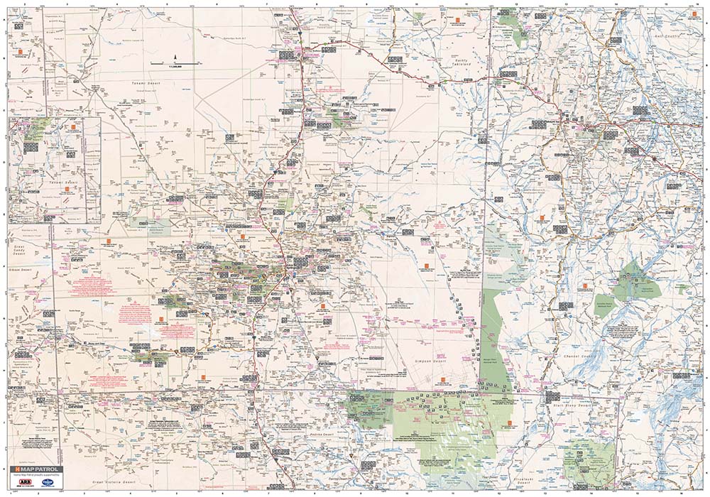

Description
The Ultimate Wall Map for Outback Planning & Adventure
Scale: 1:2,000,000 | Size: 1000 mm (W) x 700 mm (H)
Laminated for durability | GPS-surveyed & packed with info
Overview
Navigate the vast and remote heart of the continent with confidence using the Central Australia Laminated Wall Map by Hema. Now more detailed and informative than ever, this updated edition combines GPS-accurate cartography with rich, travel-focused content—including text, photographs, and essential outback information.
Whether you're planning a 4WD trek along the Tanami Track, hunting down fuel stops in the Red Centre, or simply mapping out your journey across Australia’s most iconic landscapes, this wall map is your go-to reference. Its laminated surface allows for dry-erase planning and long-lasting use—perfect for explorers, tour planners, or armchair adventurers alike.
🗺️ Map Highlights
-
Newly added photos and descriptions of key destinations and travel routes
-
Inset map of the Tanami Track (North) – now covers the full length of the track
-
Hundreds of marked locations with latitude and longitude coordinates
-
Clearly marked fuel supply points, including unleaded, leaded, autogas, and EFTPOS availability
-
Essential features for navigation, logistics, and sightseeing
Key Features
| Feature | Benefit |
|---|---|
| GPS-Surveyed Roads & Tracks | Trusted accuracy for outback navigation and trip planning |
| Latitude & Longitude Markers | Find precise coordinates for hundreds of key locations |
| Fuel & Supply Information | Know where to stop for fuel (including autogas) and Eftpos access |
| National Parks & Public Land Areas | Explore and understand protected regions and outback terrain |
| What to See & Do | Highlights local attractions, natural landmarks, and points of interest |
| Emergency & Contact Info | Includes vital contacts and travel resources for remote travel |
Laminated for Durability & Reusability
-
Encapsulated in 80-micron gloss laminate
-
Water-resistant and tear-resistant
-
Wipe-clean surface—use whiteboard markers for notes and route planning
-
Perfect for classrooms, offices, 4WD garages, or planning walls
-
Flattened and laminated from a folded version—minor fold lines may be visible
Perfect For:
-
4WD enthusiasts and overlanders
-
Outback tour guides and travel planners
-
Adventurers preparing for the Tanami Track, Red Centre, or Simpson Desert
-
Geography classrooms and educational displays
-
Home or office décor for lovers of Australian exploration
Product Specifications
-
Scale: 1:2,000,000
-
Size: 1000 mm (W) x 700 mm (H)
-
Finish: Gloss-laminated (80 micron encapsulation)
-
Map Type: Wall map (flattened and laminated from folded original)
-
Publisher: Hema Maps – Australia's leading outback cartographer
Your Guide to the Heart of Australia
From Alice Springs to the farthest reaches of the desert, the Central Australia Hema Wall Map is designed to support, inspire, and inform your journey through one of the most spectacular and remote regions on Earth. Whether it’s pinned above your desk or on the wall of your 4WD shed, it’s more than a map—it’s the start of your next great adventure.
Add to your cart now and start planning the ultimate journey through Central Australia.