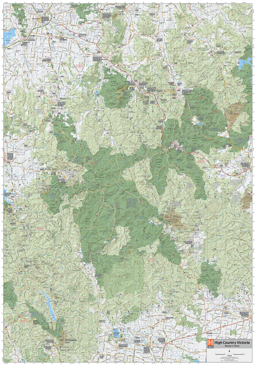
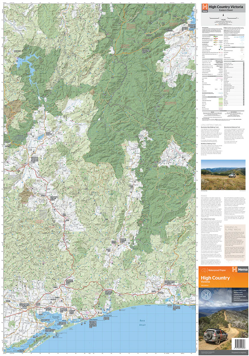
Your Ultimate 4WD and Adventure Map for Victoria's Rugged Alpine Region
This detailed laminated wall map of Victoria’s High Country is an essential resource for off-road adventurers, hikers, and nature lovers looking to explore one of Australia's most breathtaking and remote regions.
Produced by Hema Maps, Australia's most trusted name in outdoor cartography, this updated edition features digitally-enhanced mapping with GPS-surveyed roads and 4WD tracks across the Victorian Alps.
🏕️ Expanded Coverage
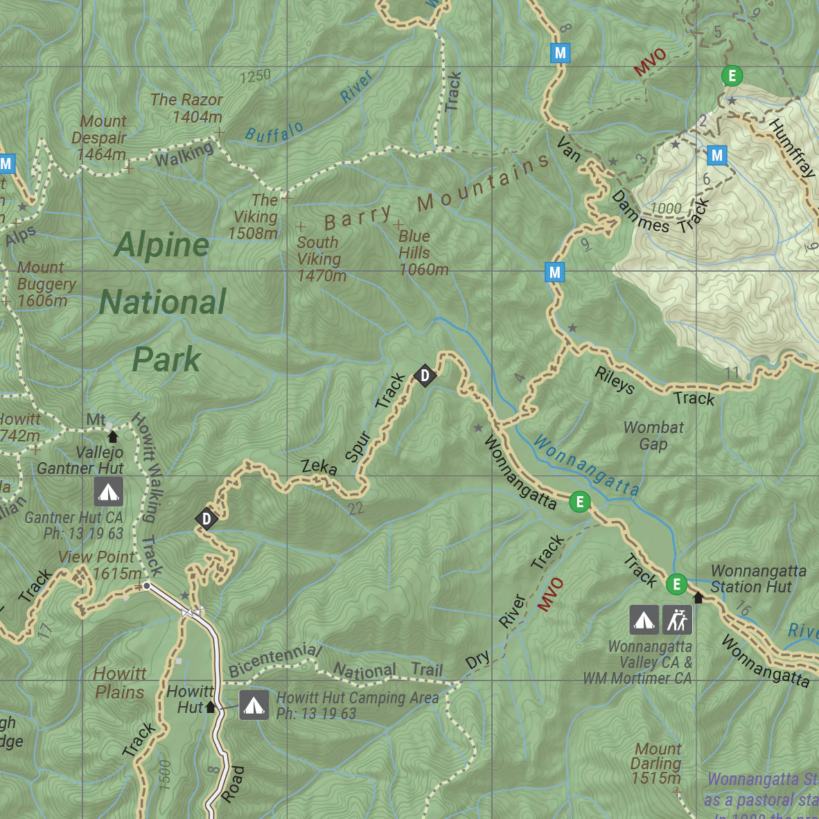
The map stretches from Wangaratta and Jindabyne in the north down to Bairnsdale and Orbost in the south, encompassing key adventure hubs such as Mount Hotham, Omeo, Bright, Mansfield, and the remote tracks of Alpine and Snowy River National Parks.
🔍 Map Features
| Feature | Description |
|---|---|
| Scale | 1:200,000 – Detailed enough to track minor routes and campsites |
| 4WD Track Highlights | Seasonal closures marked for safe planning |
| GPS Grid Overlay | Ideal for precise navigation with handheld GPS units |
| Road & Track Distances | Accurate measurements to help with fuel planning and trip logistics |
| Huts & Historic Sites | Iconic High Country huts and old townsites are clearly marked |
| Camping & Accommodation | Easily find designated campgrounds, caravan parks, and lodging |
| Fuel Supply Points | Remote fuel locations clearly noted for overlanders |
| Hiking Trails | Trails for bushwalking and alpine treks included |
| Information Contacts | Handy reference panel with park and visitor contact numbers |
🧭 Adventure-Ready Design
This map is printed on waterproof and tear-resistant synthetic paper, making it perfect for use in the field. It's also laminated using high-quality 80-micron gloss encapsulation, which allows you to:
-
Write on the map using whiteboard markers
-
Apply map dots to mark your travel highlights
-
Wipe clean and reuse for multiple trips
Note: As this is a folded map professionally laminated, some minor crease lines will still be visible.
📐 Specifications
| Specification | Details |
|---|---|
| Scale | 1:200,000 |
| Map Dimensions | 695 mm (w) x 995 mm (h) |
| Material | Waterproof/Tearproof paper, laminated |
| Publisher | Hema Maps, Australia |
🏞️ Why Choose This Map?
Whether you're tackling the Blue Rag Range, chasing waterfalls in Wonnangatta Valley, or tracing alpine huts made famous by bush legends, this wall map is the ultimate planning companion. Equally suited for trip prep, navigation, or as a functional wall display in your home, garage, or 4WD clubroom.
Ready for your next High Country escape? This is the map you need on the dash or the wall.