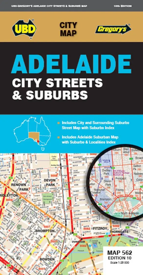
Victoria & Melbourne Postcode Laminated Wall Map 1036 x 788mm
Victoria & Melbourne Postcode Laminated Wall Map · 1036 × 788 mm
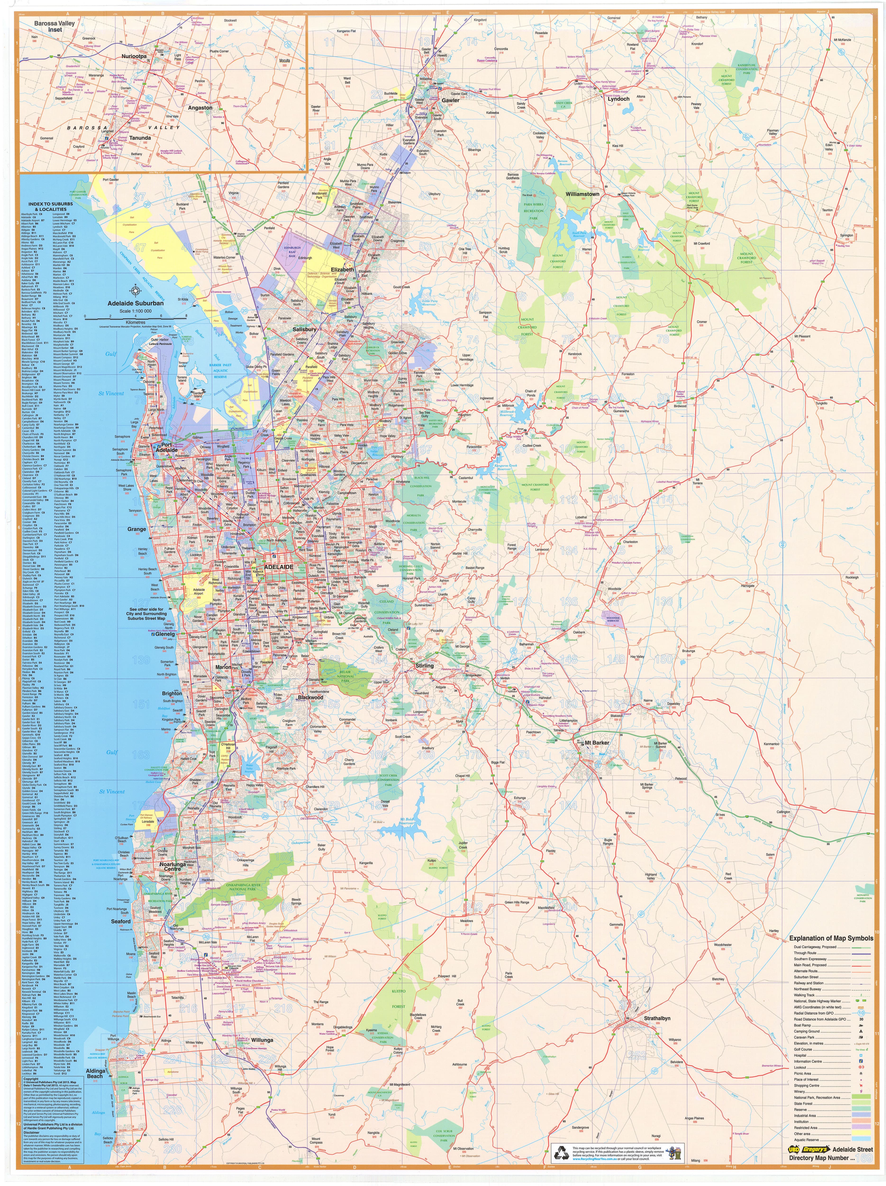
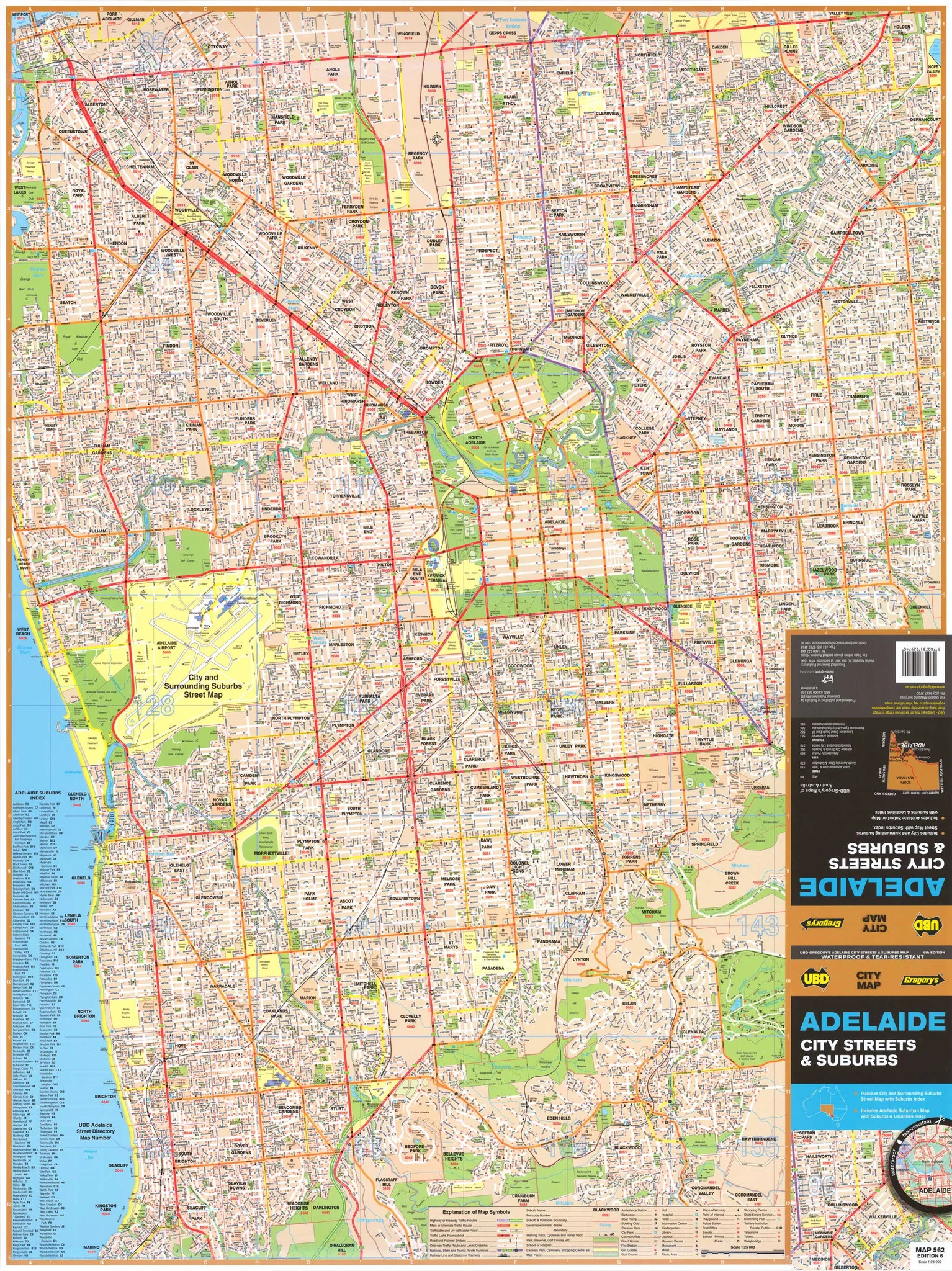
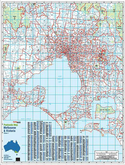
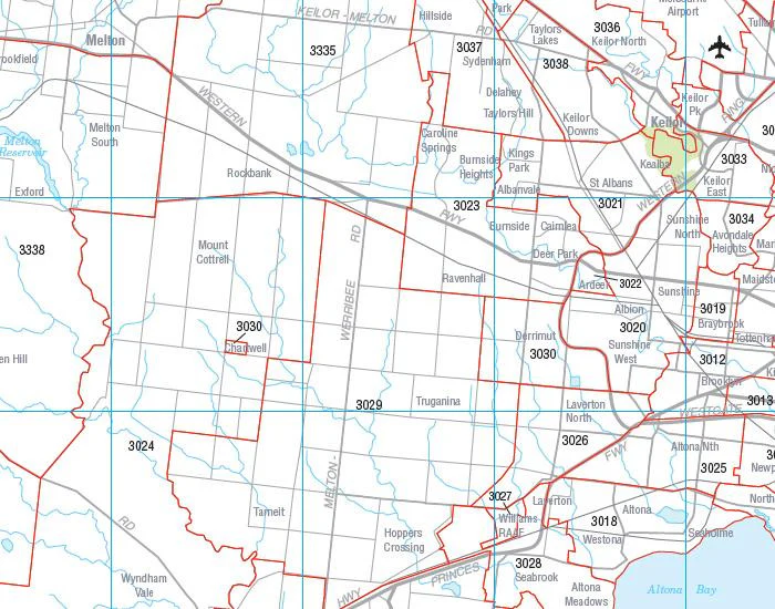
The definitive postcode planning map for Victoria and its capital, Melbourne. Cartodraft’s Victoria & Melbourne Postcode Map shows every postcode boundary and number across the state—zooming from metropolitan Melbourne’s dense suburbs to regional towns, coastal hubs, and rural communities. Finished in a robust write-on/wipe-off laminate, this map is built for logistics, sales, service planning, government, and education.
✅ Why this map works
-
Complete statewide coverage — from central Melbourne through Geelong, Bendigo, Ballarat, Mildura, Gippsland, and beyond
-
Dual focus — detailed Melbourne metro paired with full Victoria postcode clarity
-
Comprehensive suburb & town index — quick postcode confirmation at a glance
-
True write & wipe surface — annotate with whiteboard markers; erase cleanly with no ghosting
-
Mark-It-Dots compatible — highlight depots, service areas, or hotspots without damaging the laminate
-
Professional-grade tool — trusted by sales teams, logistics managers, planners, government agencies, and educators
🪵 Premium materials (made to last)
-
Heavy base stock — stable, smooth paper ensures crisp lines and vibrant colour
-
True encapsulation lamination — sealed in 2 × 80-micron gloss film, waterproof and tear-resistant
-
Reusable write-on/wipe-off finish — designed for daily use with standard whiteboard markers
-
Edge-sealed protection — resists fraying and moisture in high-use settings
-
Colour-managed printing — high contrast for wall-distance readability
✨ Optional upgrade: Laminated + Timber Hang Rails — natural lacquered rails fitted top & bottom with a hanging cord for a polished, ready-to-hang display.
⏱️ Please allow up to 10 working days for hang-railed maps.
🧾 What’s on the map
-
Victoria postcode boundaries & numbers statewide
-
Detailed Melbourne metro coverage for dense suburban areas
-
Comprehensive suburb & town index for fast reference
-
Major highways, transport corridors, and features (as supplied by Cartodraft)
📐 Size & display
-
1036 × 788 mm (landscape) — wide format for readability and balance on office or classroom walls
-
Mount directly with 3M picture strips, screws, or upgrade to timber hang rails for a professional finish
📦 Practical uses
-
Sales & franchise planning — allocate and adjust postcode-based territories
-
Logistics & courier services — manage metro delivery runs and regional freight networks
-
Government & administration — reference tool for service planning, outreach, and compliance
-
Education & training — ideal for geography, planning, and business studies
-
Office & boardroom display — functional, clear, and impressive as a wall feature
🧽 Care & maintenance
-
Wipe gently with a soft dry or slightly damp cloth
-
Use only whiteboard markers (avoid permanent/ethanol-based pens)
-
Remove dots or tape carefully to protect the laminate seal
📊 Specifications
| Field | Detail |
|---|---|
| Title | Victoria & Melbourne Postcode Laminated Wall Map |
| Publisher | Cartodraft |
| Coverage | Statewide Victoria with detailed Melbourne metro |
| Index | Suburb & town index with postcodes |
| Colour-managed, high-contrast cartography | |
| Lamination | 2 × 80-micron gloss film, fully encapsulated, edge-sealed |
| Surface | Write-on/wipe-off (whiteboard-marker compatible) |
| Orientation & Size | Landscape — 1036 × 788 mm |
| Optional Display | Laminated + Timber Hang Rails (natural lacquered; allow up to 10 working days) |
| Best for | Sales, logistics, franchise planning, service coverage, education |
🇦🇺 Our commitment
-
Made & printed in Australia — supporting local production and expertise
-
Hand-finished lamination — carefully sealed edges for strength and long life
-
Colour-managed workflow — ensures consistent clarity and accuracy in every print run
-
Packed with care — shipped in heavy-duty tubes or flat-packed for safe delivery
-
Family-run expertise — decades of cartographic knowledge built into every map
Plan Victoria and Melbourne with confidence. Select your finish, add accessories, and bring postcode clarity to your wall today.
Original: $109.95
-70%$109.95
$32.98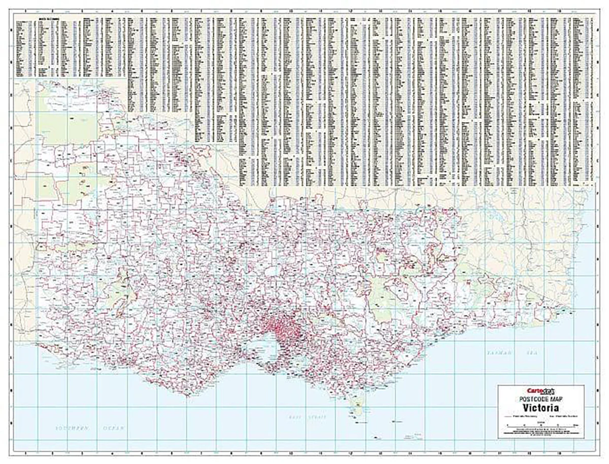
Description
Victoria & Melbourne Postcode Laminated Wall Map · 1036 × 788 mm
The definitive postcode planning map for Victoria and its capital, Melbourne. Cartodraft’s Victoria & Melbourne Postcode Map shows every postcode boundary and number across the state—zooming from metropolitan Melbourne’s dense suburbs to regional towns, coastal hubs, and rural communities. Finished in a robust write-on/wipe-off laminate, this map is built for logistics, sales, service planning, government, and education.
✅ Why this map works
-
Complete statewide coverage — from central Melbourne through Geelong, Bendigo, Ballarat, Mildura, Gippsland, and beyond
-
Dual focus — detailed Melbourne metro paired with full Victoria postcode clarity
-
Comprehensive suburb & town index — quick postcode confirmation at a glance
-
True write & wipe surface — annotate with whiteboard markers; erase cleanly with no ghosting
-
Mark-It-Dots compatible — highlight depots, service areas, or hotspots without damaging the laminate
-
Professional-grade tool — trusted by sales teams, logistics managers, planners, government agencies, and educators
🪵 Premium materials (made to last)
-
Heavy base stock — stable, smooth paper ensures crisp lines and vibrant colour
-
True encapsulation lamination — sealed in 2 × 80-micron gloss film, waterproof and tear-resistant
-
Reusable write-on/wipe-off finish — designed for daily use with standard whiteboard markers
-
Edge-sealed protection — resists fraying and moisture in high-use settings
-
Colour-managed printing — high contrast for wall-distance readability
✨ Optional upgrade: Laminated + Timber Hang Rails — natural lacquered rails fitted top & bottom with a hanging cord for a polished, ready-to-hang display.
⏱️ Please allow up to 10 working days for hang-railed maps.
🧾 What’s on the map
-
Victoria postcode boundaries & numbers statewide
-
Detailed Melbourne metro coverage for dense suburban areas
-
Comprehensive suburb & town index for fast reference
-
Major highways, transport corridors, and features (as supplied by Cartodraft)
📐 Size & display
-
1036 × 788 mm (landscape) — wide format for readability and balance on office or classroom walls
-
Mount directly with 3M picture strips, screws, or upgrade to timber hang rails for a professional finish
📦 Practical uses
-
Sales & franchise planning — allocate and adjust postcode-based territories
-
Logistics & courier services — manage metro delivery runs and regional freight networks
-
Government & administration — reference tool for service planning, outreach, and compliance
-
Education & training — ideal for geography, planning, and business studies
-
Office & boardroom display — functional, clear, and impressive as a wall feature
🧽 Care & maintenance
-
Wipe gently with a soft dry or slightly damp cloth
-
Use only whiteboard markers (avoid permanent/ethanol-based pens)
-
Remove dots or tape carefully to protect the laminate seal
📊 Specifications
| Field | Detail |
|---|---|
| Title | Victoria & Melbourne Postcode Laminated Wall Map |
| Publisher | Cartodraft |
| Coverage | Statewide Victoria with detailed Melbourne metro |
| Index | Suburb & town index with postcodes |
| Colour-managed, high-contrast cartography | |
| Lamination | 2 × 80-micron gloss film, fully encapsulated, edge-sealed |
| Surface | Write-on/wipe-off (whiteboard-marker compatible) |
| Orientation & Size | Landscape — 1036 × 788 mm |
| Optional Display | Laminated + Timber Hang Rails (natural lacquered; allow up to 10 working days) |
| Best for | Sales, logistics, franchise planning, service coverage, education |
🇦🇺 Our commitment
-
Made & printed in Australia — supporting local production and expertise
-
Hand-finished lamination — carefully sealed edges for strength and long life
-
Colour-managed workflow — ensures consistent clarity and accuracy in every print run
-
Packed with care — shipped in heavy-duty tubes or flat-packed for safe delivery
-
Family-run expertise — decades of cartographic knowledge built into every map
Plan Victoria and Melbourne with confidence. Select your finish, add accessories, and bring postcode clarity to your wall today.